August 19, 2019
You’re preparing for a public meeting to communicate the pros and cons of two different bike lane facility alternatives. You want thoughtful feedback that comes not just from the facts, but from understanding how different each of these bike facilities will feel to users.
Stories, statistics, and static images can be helpful – but why not immerse community members in an environment where they can see each facility come to life and experientially understand the stressors? This is the power of advanced visualization technology. It’s effective, and surprisingly attainable.
We’re here to tell you how. This article explains how augmented reality and virtual reality are being used in transportation planning and engineering, and the future opportunities for agencies looking to creatively engage community members in planning decisions.
Augmented Reality (AR) in Transportation Planning
If you’ve used a Snapchat filter or tried your hand at Pokemon Go, you’ve already interacted with augmented reality. Augmented reality simply means enhancing an image, video or scene through the overlay of digital information.
Using augmented reality, you can place one image or video over another so that it comes to life through the viewfinder of a smartphone or tablet. You can overlay a video over a static image, or one video over another to review differences between various alternatives. (It’s not just in the world of Harry Potter where printed photos can have movement!)
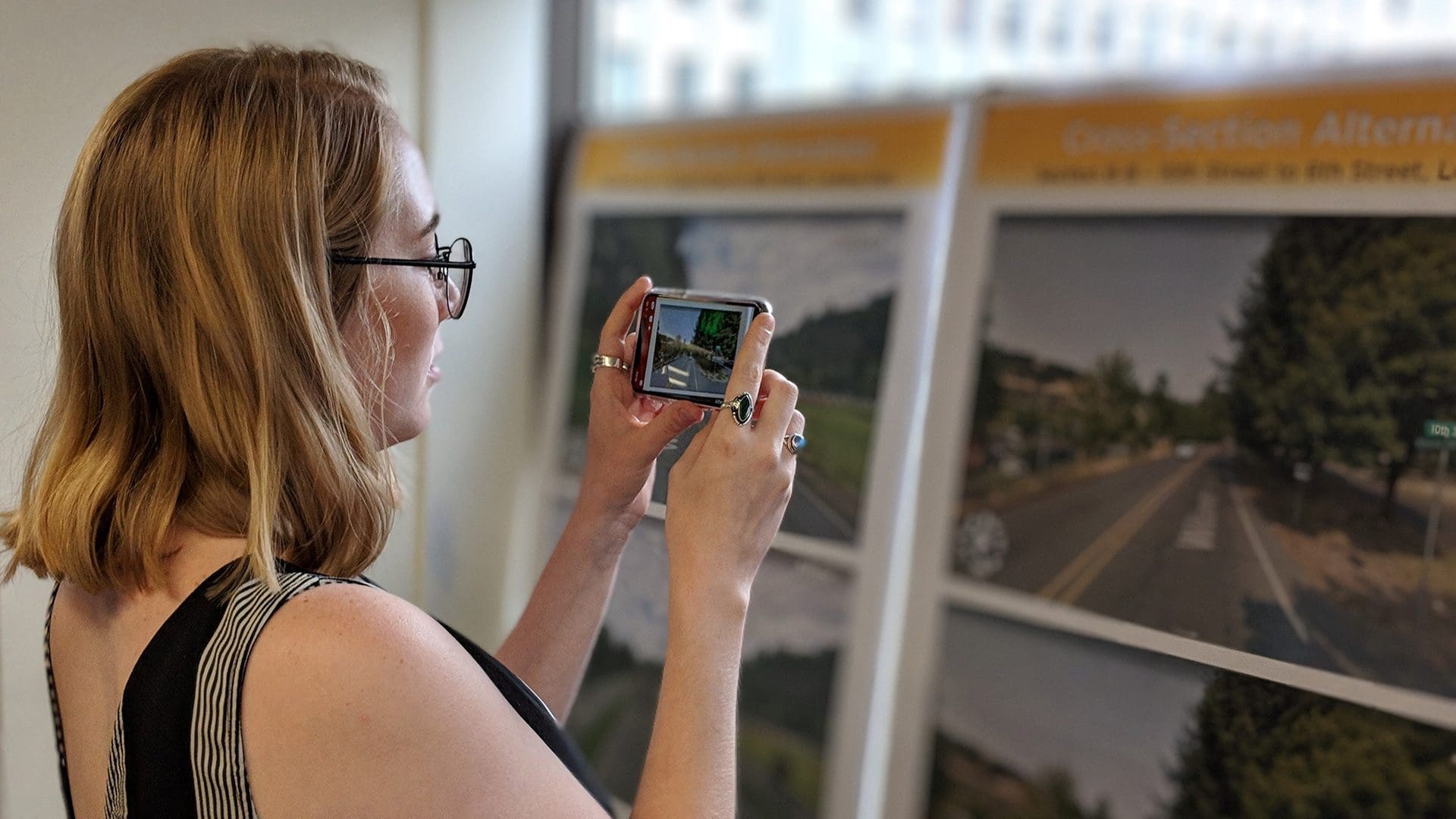
Augmented Reality in Transportation Planning
April Olson tests out an AR setup in the Kittelson office.
AR can also be used to add a dimension to a 2D image. Through pointing a smart device at a printed piece, a viewer can watch a scene come to life in 3D and gets a better feel for concepts like height, depth, and distance between objects.
Today, you’ll find AR being across a wide span of industries, from an architect’s office to a hospital. Some doctors are using AR during surgery to “see inside” their patients before making an incision, through technologies that blend computer-generated images and data from MRI and CT scans with real-world views to examine bones, muscles, and internal organs.
Assembling an AR setup can take as little as a few hours, and when we incorporate it in community engagement efforts, it makes a big splash. You can use AR to preview how future conditions will look, show a clear before/after change, or just to get more foot traffic at your poster board display. AR is also a great tool when you’re in an outdoor environment and it’s not practical to bring a computer to play video footage, but you still want to demonstrate operational activity.
When we bring augmented reality into transportation planning projects, we've seen it change the entire feel of a public meeting.
At public meetings, we’ll often set up a large floor aerial or wall mounted posters displaying existing conditions. Attendees who install the app prior to the meeting can use their own devices to view the different alternatives, or they can use one of our provided devices. Through the app, static images transform into Vissim animations displaying multimodal activity, and viewers can watch how the alternative is navigated. We tend to see attendees quickly form comments and questions, demonstrating a high level of engagement.
See It For Yourself
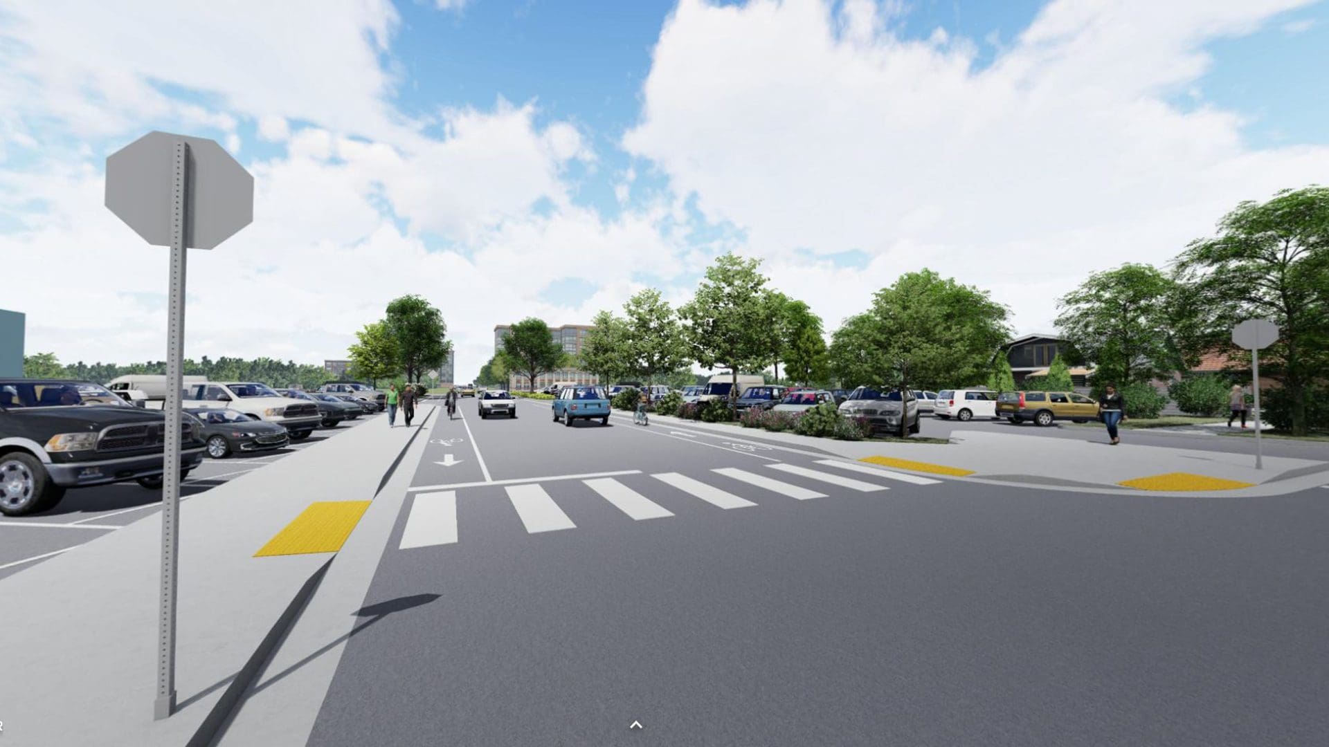
We recently used AR technology to show before/after improvements for a corridor project in West Linn, Oregon. Using Google Streetview as the tracking image, the smart device overlays an image with animations of what the corridor could look like in the future.
To see what public meeting attendees saw, all you’ll need is the image below, a smart device, and the Zappar app. Once you’ve opened the app, simply hold your phone up to the screen, scan the logo, and the scene will come to life.
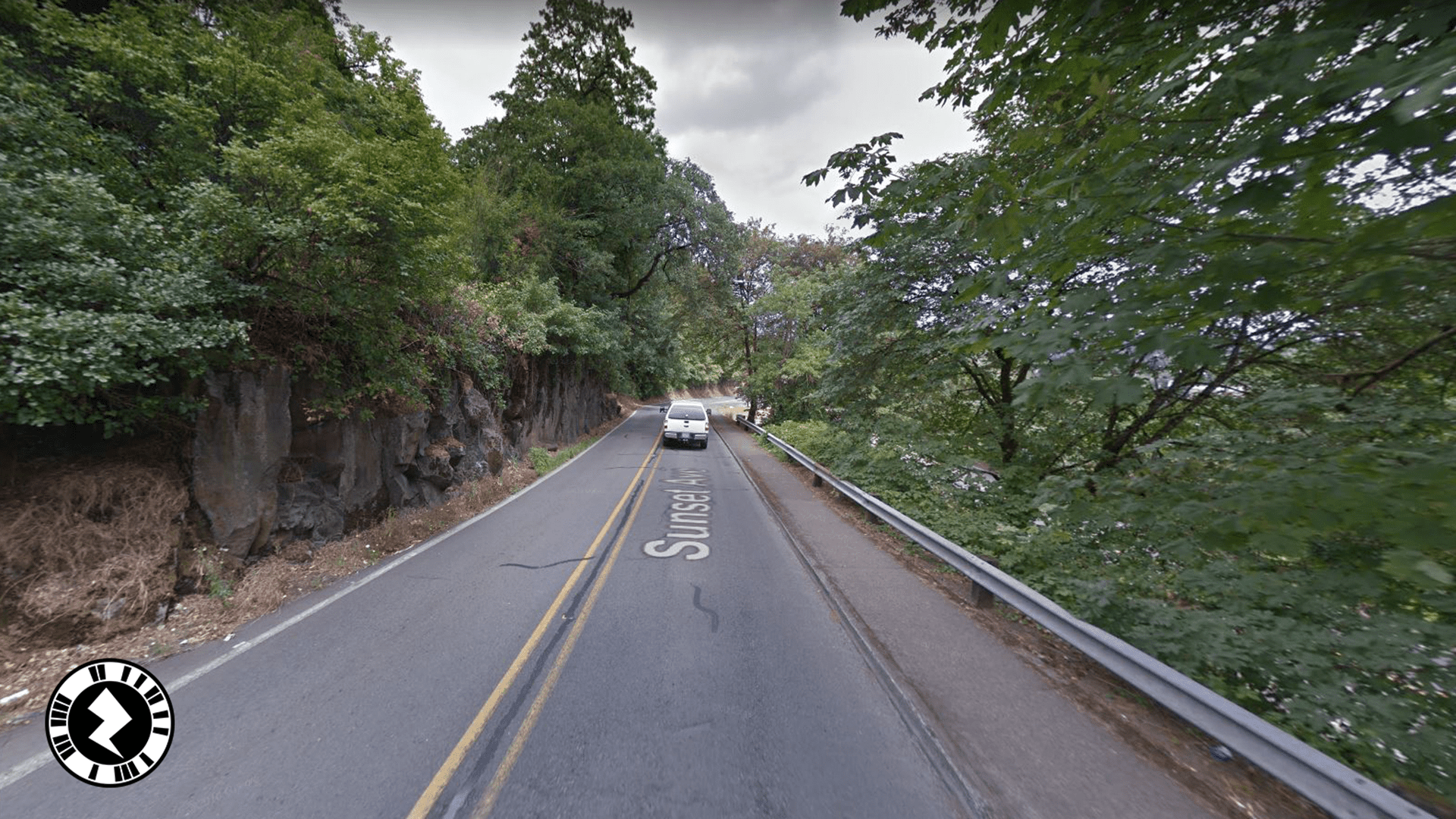
Augmented Reality demonstration for West Linn, Oregon
Scan this image with the Zappar app to see the proposed sidewalk and bike lane!
Virtual Reality (VR) in Transportation Planning
The next level of visualization technology is virtual reality, in which a viewer is transported into an immersive 3D environment. This is most commonly accomplished through use of a headset, such as the Google Cardboard or Oculus Rift.
Inside this 3D world, the viewer can explore the scene, with varying degrees of interaction. The simplest setup is essentially a 360-degree photograph. The headset takes two separate images – one for the left eye and one for the right eye – and melds them together to make it look three-dimensional. By looking up and down or moving in a circle, the viewer can explore every angle of the scene.
We recently brought this type of VR setup to an outdoor public meeting in Boise. We mounted posters on a mobile public outreach van that was parked right next to 11th Street, the corridor in discussion, and supplemented them with VR headsets hooked up to smartphones with a 360 rendering of one of the bike lane alternatives. We assembled the simulation using CAD, 3D modeling, and satellite imagery.
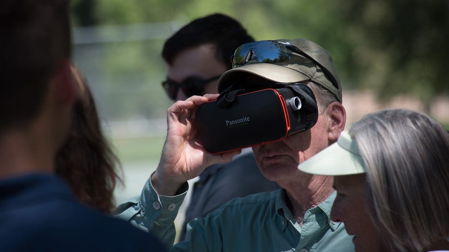
Using augmented reality at a public meeting in Boise
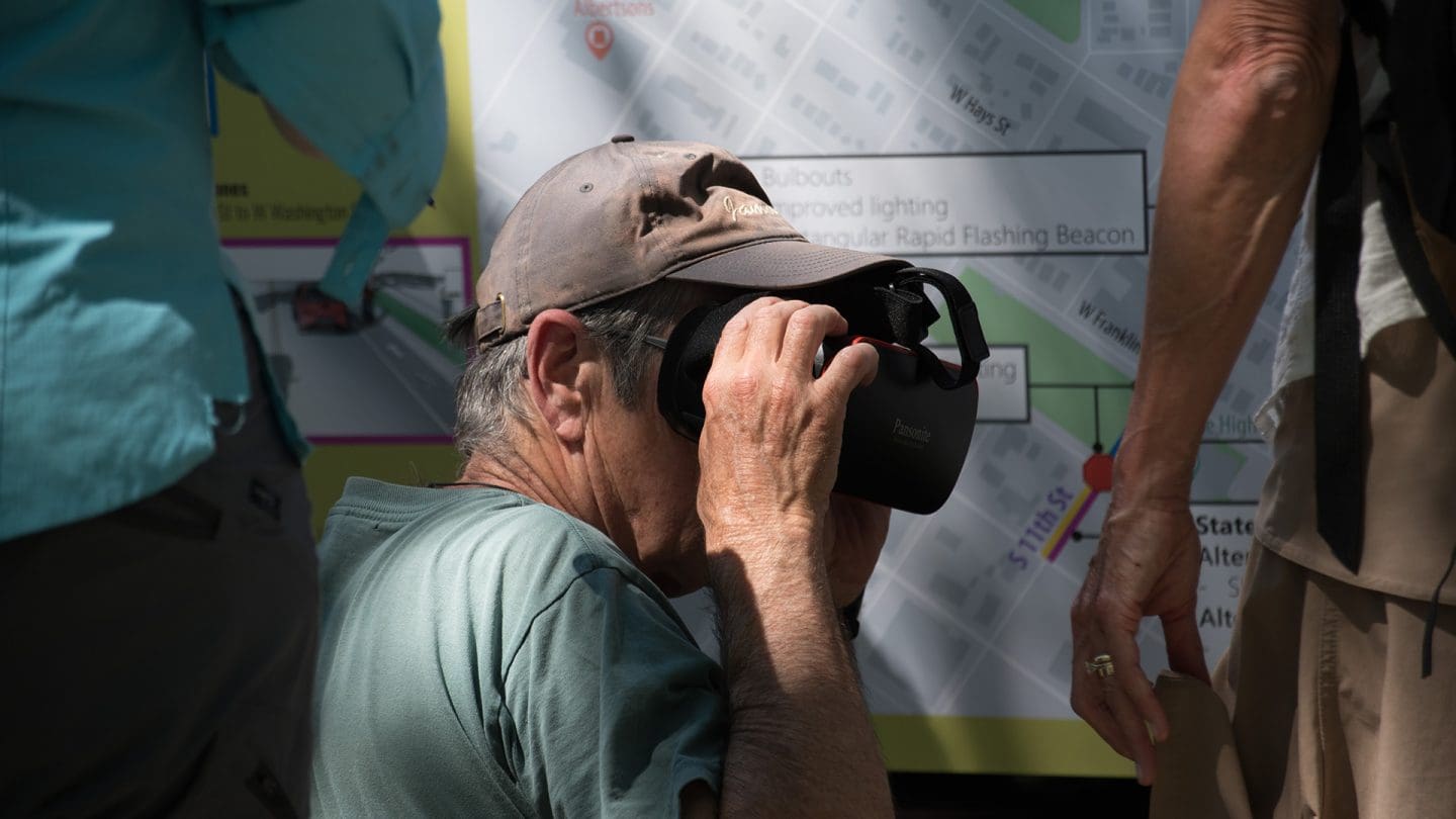
Using augmented reality at a public meeting in Boise
The posters sparked some discussion, but we saw attendees’ entire demeanors change when they put on the headset. The ideas suddenly had life and the appearance of physical form, and the conversation flowed quickly.
Similarly, at a public meeting in Orlando, we needed community input on traffic diversion to neighborhood streets. Rather than trying to interpret travel demand models and telling community members what they were supposed to see, we used a combination of virtual reality and Google travel time to set up realistic scenarios that they could see and experience for themselves. Attendees had so much fun that we had to kindly ask people to leave at the end of the night.
The highest level of interaction in virtual reality is the ability to move through a scene and even change it. Complex VR environments are enhanced 3D models that use repetitive pre-defined animations and interactive “buttons” created in the gaming engine. Using a hand controller, the viewer can walk around, pick things up, and click to see under-the-surface infrastructure. In a transportation planning context, you can toggle between seeing the existing conditions and proposed design to understand the options on the table.
See It For Yourself
While it’s not entirely the same as having the headset on, you can check out the scene we created for 11th Street in Boise! Click and drag to explore the scene on your computer, tablet or phone.
Virtual reality demonstration of 11th Street in Boise
Click here to explore the 360-degree image we built to show what the 11th Street bike lane facility alternative would look and feel like.
Future Opportunities with AR and VR For Transportation Planning
AR and VR provide highly engaging environments for gathering information. Not only can this be effective to communicate planning concepts, but there are tremendous practical possibilities from an engineering standpoint. In an immersive VR experience, you can move through a design and examine all the elements. You can point to a rail and learn what type it is, how long it is, and what it costs. You can look at pipes under the surface. You can push the buttons on a signal pole to make the crosswalk light flash. AR can be used in construction to help visualize complex designs and see how things fit together. Building Information Modeling (BIM) data can be incorporated into these experiences, giving you the ability to make engineering decisions and test out designs in new ways.
AR and VR are the future of the visualization field, and we have loved introducing it to our clients and applying it to projects where appropriate. If you want to talk about this topic in more detail, reach out to any one of us who have been involved!
- Steven Rhyne, Visual Communication Specialist
- Zachri Jensen, Transportation Analyst
- Andrew Bailey, Senior Engineer
- Aditya Inamdar, Urban Planner/Designer
- Alex Reasbeck, Urban Planner
- DJ Gregory, CAD Technician