May 20, 2023
We may not often stop to say “thank you” to storm drains, streetlights, or bridges, but public works projects are an important part of our daily lives. Public works is also a critical part of a transportation network that connects communities with safe, efficient, multimodal choices in sustainable ways, and that protects the physical environment and social fabric of our neighborhoods.
National Public Works Week gives us a chance to celebrate the role of public works projects in our communities. The theme for Public Works Week 2023 is “Connecting the World Through Public Works,” celebrating how public works connects people through infrastructure and service.
In addition to being part of every community, public works is part of every design project we take on at Kittelson. Public works components of transportation projects range from roadway design to stormwater conveyance and treatment to street lighting, traffic signals, landscape design, and bridges.
In celebration of Public Works Week and recognition of our hardworking transportation design practice, here are eight projects that faced interesting public works challenges.
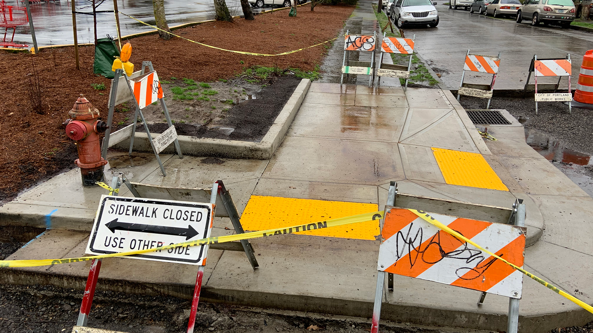
#1: Streamlining the Curb Ramp Design and Construction Process
ADA Compliant Curb Ramps: Portland, OR
Tens of thousands of existing curb ramps are not ADA compliant, due to loose guidance in the construction stage, conflicting requirements between design and construction, and tight metrics for judging compliance of the constructed ramp. As a result, agencies are looking for streamlined and cost-effective methods for reworking their curb ramps en masse.
A Kittelson team worked with the Portland Bureau of Transportation (PBOT) on two alternative curb ramp design methods. The first method utilizes the City of Portland’s extensive GIS mapping combined with in-field measurements by the design engineer (rather than a full-scale topographic survey). This method starts with setting a reference point or a Bench Mark using a PK nail with a relative set elevation in the curb about 30 feet outside the estimated limits of construction, making the design specific to that location where we collect data. Using a laser level at the intersection, the next step is to pull field measurements with a tape measure to key points of interest around the corner, and measure elevations to those points using the PK nail as the vertical reference point. The hand sketch effectively becomes the 30% concept layout.
In our work with PBOT, we’ve also used Rieker’s Advanced Data and Acquisition Measurement (ADAM) system, a forensic data acquisition tool that quickly measures curb ramps with National Institute of Standards and Technology (NIST) traceability. Though originally developed to be used in documenting ramp compliance, data collected by the tool can also be used for design. This tool uses 3D scanning technology that takes pictures at certain intervals and creates a point cloud so we can access elevation data associated with the isolated corner we’re designing. Similar to the first method, this tool allows the civil engineer to collect the data and do the design so they are in control from beginning to end.
Regardless of the data collection method, we then brought the data and hand sketched notes to the office to prepare the CAD design, check our work in the field again, then prepare a 60% design package. Submittals were delivered under the typical process and we prepared a final bid package that included technical specifications, plans, and bid quantities for the contractor to bid. PBOT has on-call contractors for the curb ramp program, which also streamlines construction contracting.
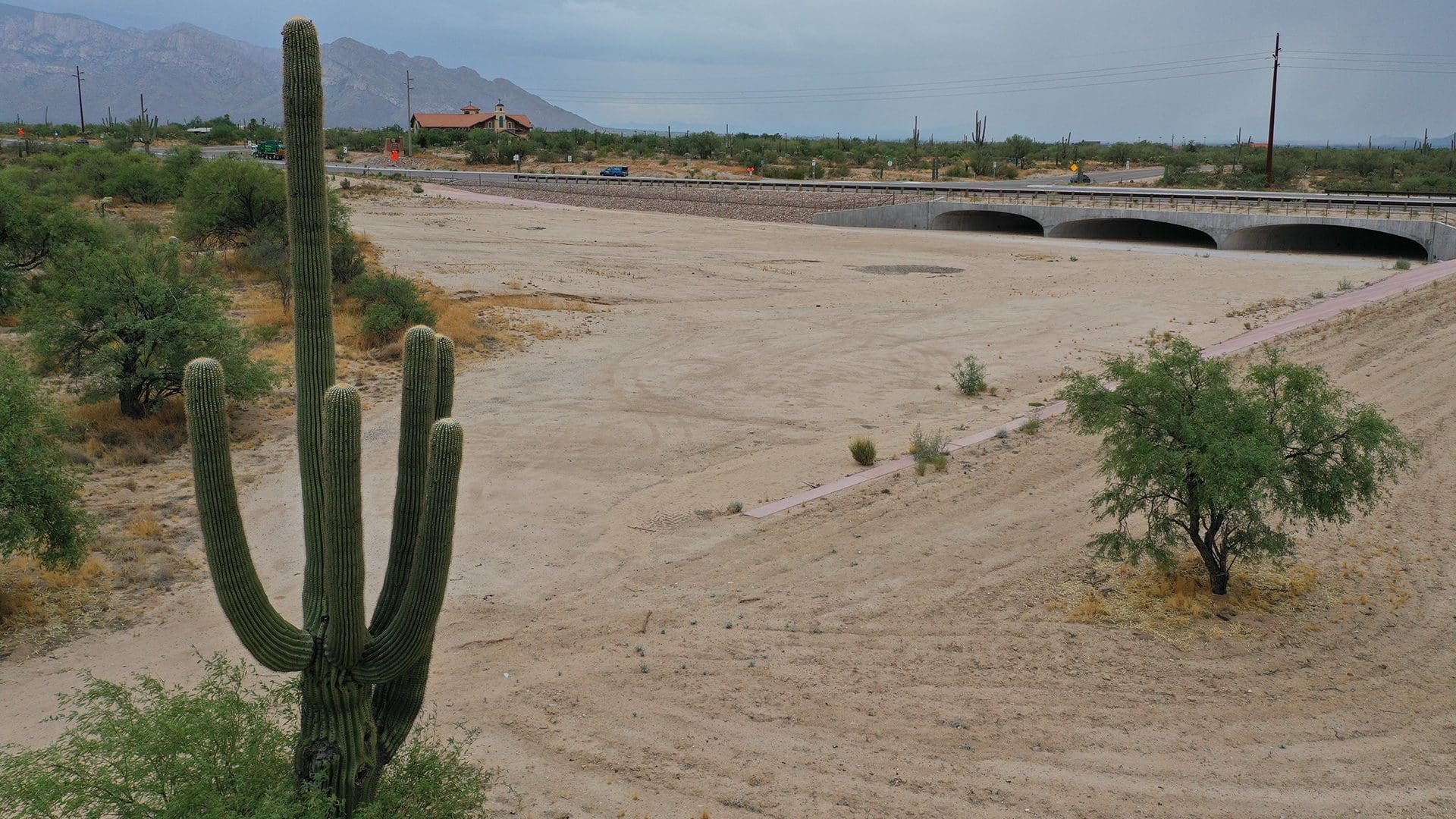
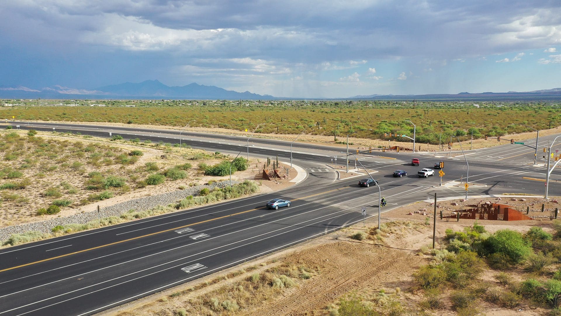
#2: Roadway Reconstruction to Provide All-Weather Access
Tangerine Road: Tucson, AZ
Prior to construction, this segment of Tangerine Road was highly susceptible to flooding, greatly hampering mobility and impacting public safety by making accessibility for emergency services difficult. There was not adequate capacity to accommodate mobility and access through this rapidly developing corridor, and pedestrian and bicycle facilities were virtually nonexistent.
Kittelson was part of a multi-disciplinary consulting team led by Psomas. Delivered through the Construction Manager at Risk (CMAR) method, the project included reconstruction of approximately five miles of two-lane roadway to four lanes of divided roadway with ped/bike facilities and the installation of additional turn lanes, in a corridor that passes through the jurisdiction of three different municipalities.
Today, the section of Tangerine Road links the Towns of Marana and Oro Valley, enhancing development opportunities, safe and efficient all-weather access for residents and businesses, and provides excellent facilities to accommodate the many bicyclists and pedestrians that use the corridor. It won Project of the Year in the $25-75 million category from APWA in 2019.
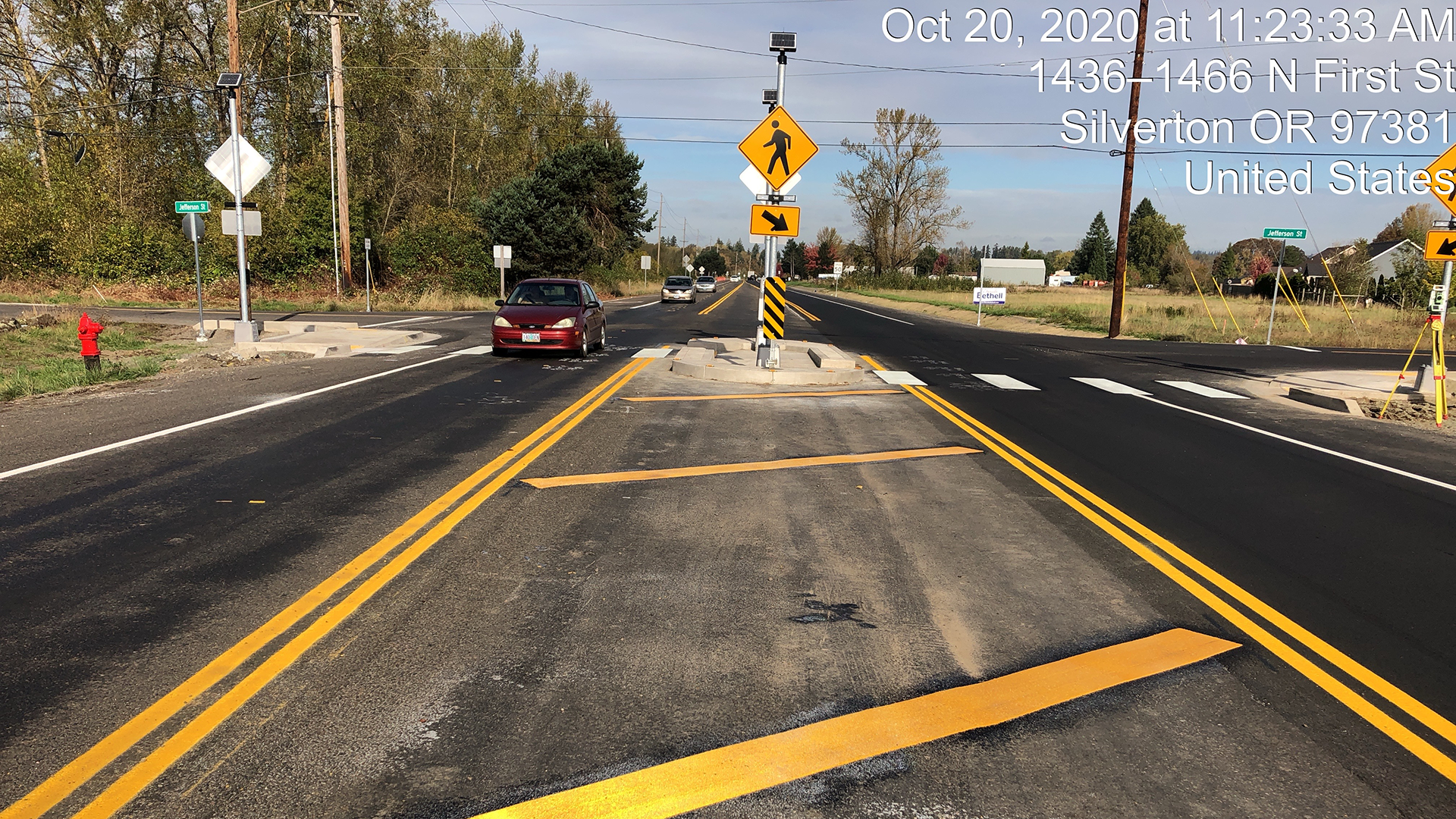
#3: A Safer Way for Pedestrians to Cross OR 214
OR 214 and Jefferson Street: Silverton, OR
OR 214 (Hillsboro-Silverton Highway) runs north/south through the City of Silverton, OR. Jefferson Street intersects the highway at the north end of Silverton and is the most direct route from residential development on the east side of the highway to Silverton High School on the west side of the highway. However, pedestrians needed a safer way to cross the highway.
Kittelson worked with the Oregon Department of Transportation (ODOT) to lead the design for this project on a fast-paced schedule, going from 0% to final design in four months. This work involved surveys, coordination with ODOT Region 2 traffic staff to address freight mobility, access management, utility coordination, pavement preservation and restoration, roadway design, signal design, illumination design, signing & striping design, and traffic management during construction.
The improvements include widening of north bound lanes, constructing a raised median pedestrian refuge, installing pedestrian activate rectangular rapid flashing beacon, illumination of the intersection, and associated signing & striping, ultimately creating a safer highway crossing for people on foot.
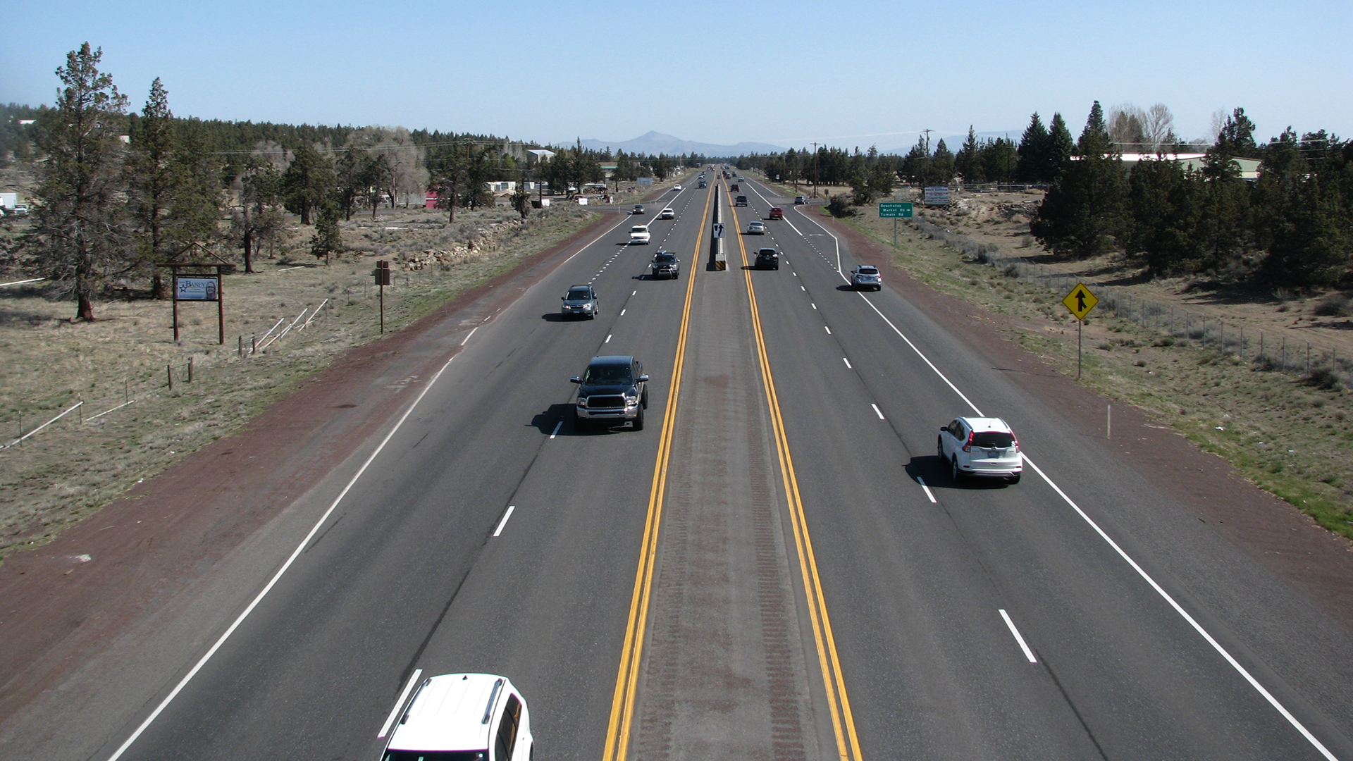
#4: Safety Improvements to Reduce Fatal and Severe Crashes
Bend to Redmond Safety Improvements: Deschutes County, OR
The US 97 corridor between Bend and Redmond is very straight and driveway density is highest in the transition sections from rural to urban areas into Bend and Redmond. With a goal of reducing fatal and severe injury crashes along the corridor, Kittelson completed a benefit-cost analysis to prioritize projects based on expected cost-effectiveness and ability to reduce crashes. This information was presented in the US 97 Safety Assessment and contributed to the Oregon Department of Transportation (ODOT) receiving funding to implement the improvements.
From there, we prepared design documents for installing safety improvements, which included acceleration and deceleration lanes at two priority intersections, recessed pavement markers, and removing rock outcroppings within and adjacent to the roadway clear zone.
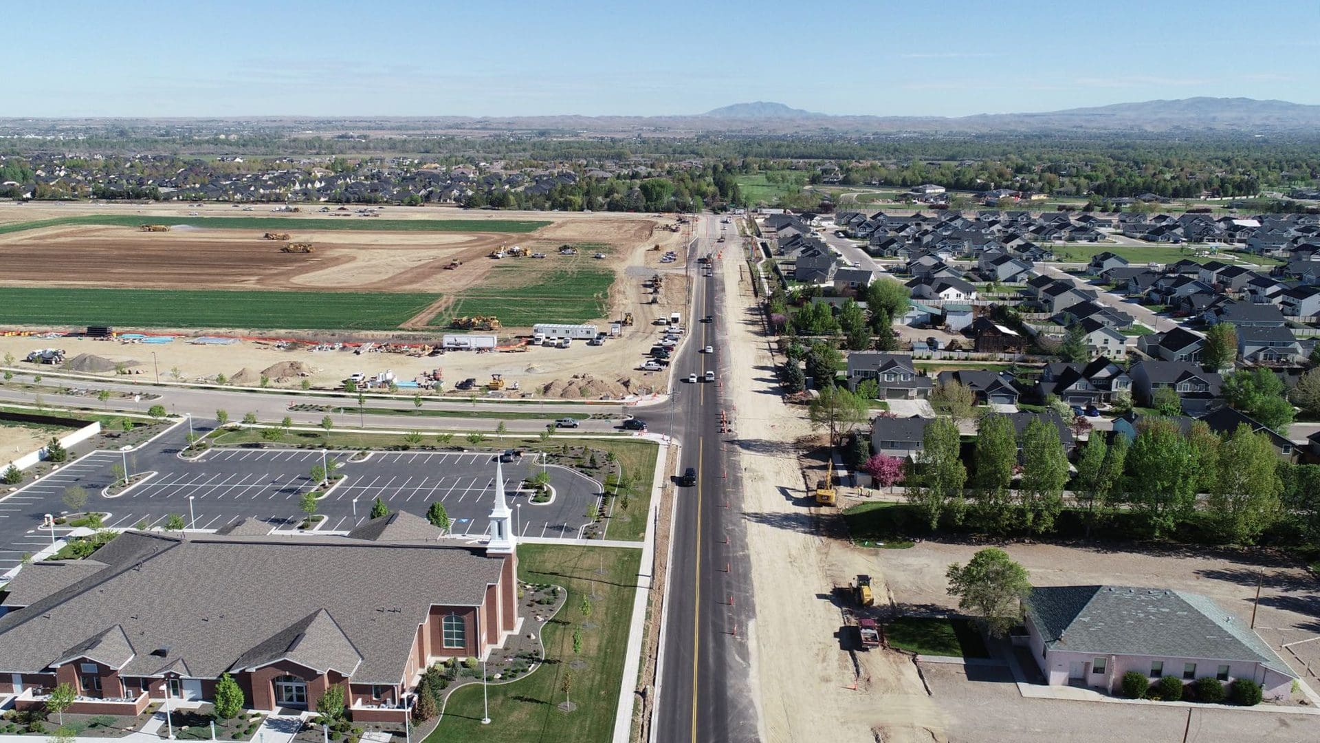
#5: Synchronizing Private Development, Agency Workflows, Right-of-Way Impacts, and Stakeholder Interests
Costco at 10 Mile Road Development: Boise, ID
US 20/26 is a vital east/west arterial connecting the Treasure Valley in Idaho from Caldwell to Boise, an area experiencing rapid growth.”¯To prepare for the opening of a new store adjacent to US 20/26, Costco Wholesale worked with Kittelson to support the development agreement process and entered into a Sales Tax Anticipated Revenue (STAR) agreement with the”¯Idaho Department of Transportation“¯for the three-mile section between Linder Road and Black Cat Road.”¯ The project required a synchronization of the fast-paced nature of private development, state and local agency workflows, extensive right-of-way impacts, and multiple stakeholder interests.”¯Per the terms of the STAR agreement, acquisitions on 36 properties, 3,600 linear feet of irrigation infrastructure, 1,300 linear feet of sound walls, three miles of multi-use pathways, five signalized intersection improvements, and nine lane-miles of roadway construction needed to be completed in under 20 months.
To meet the terms of the STAR, Kittelson proposed a unique approach to advancing right-of-way (ROW) and irrigation plans. Internally, we relied on lean project management principles and externally, our team drove the project forward by facilitating weekly stakeholder meetings, reviews, field visits, and other project activities.
The contract was advertised and awarded on-schedule, and construction began in October 2019, at the start of the irrigation winter shutdown. Because of the partnership and communication between private and public sectors, the improvements to Chinden Boulevard sped from design to completion in just two years.
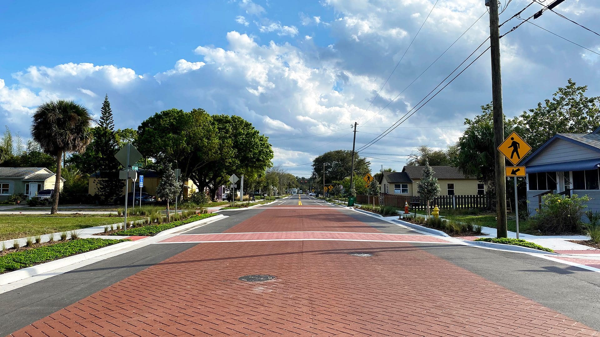
#6: Protecting a Florida Street From Flooding
Hickory Street: Melbourne, FL
Kittelson worked with the Space Coast Transportation Planning Organization, the City of Melbourne and FDOT on a complete streets project that included green infrastructure strategies to address poor soils and existing drainage issues. Our assignment was to redesign the pedestrian-active Hickory Street to include sidewalks, bicycle lanes, and landscape beautification, while making it more resilient.
We considered various flooding scenarios (a 100-year flood, rising sea levels vs. rising groundwater, etc.) and applied a series of coordinated solutions. Rain gardens were introduced in the non-curbed portions as an aesthetically pleasing method of collecting stormwater runoff. In another area that floods regularly, we designed and constructed the street using porous paving materials. The additional 8-10 inches of porous pavers help to serve as a pseudo-retention area to hold flood water until it can seep back into the ground. This solution mitigates a variety of drainage issues by not only replacing the existing impervious surface, but also lifting up the driving, bicycling, and walking surface without creating additional impervious surface or compacted soil – and it keeps people moving by preventing flooded pathways and streets.
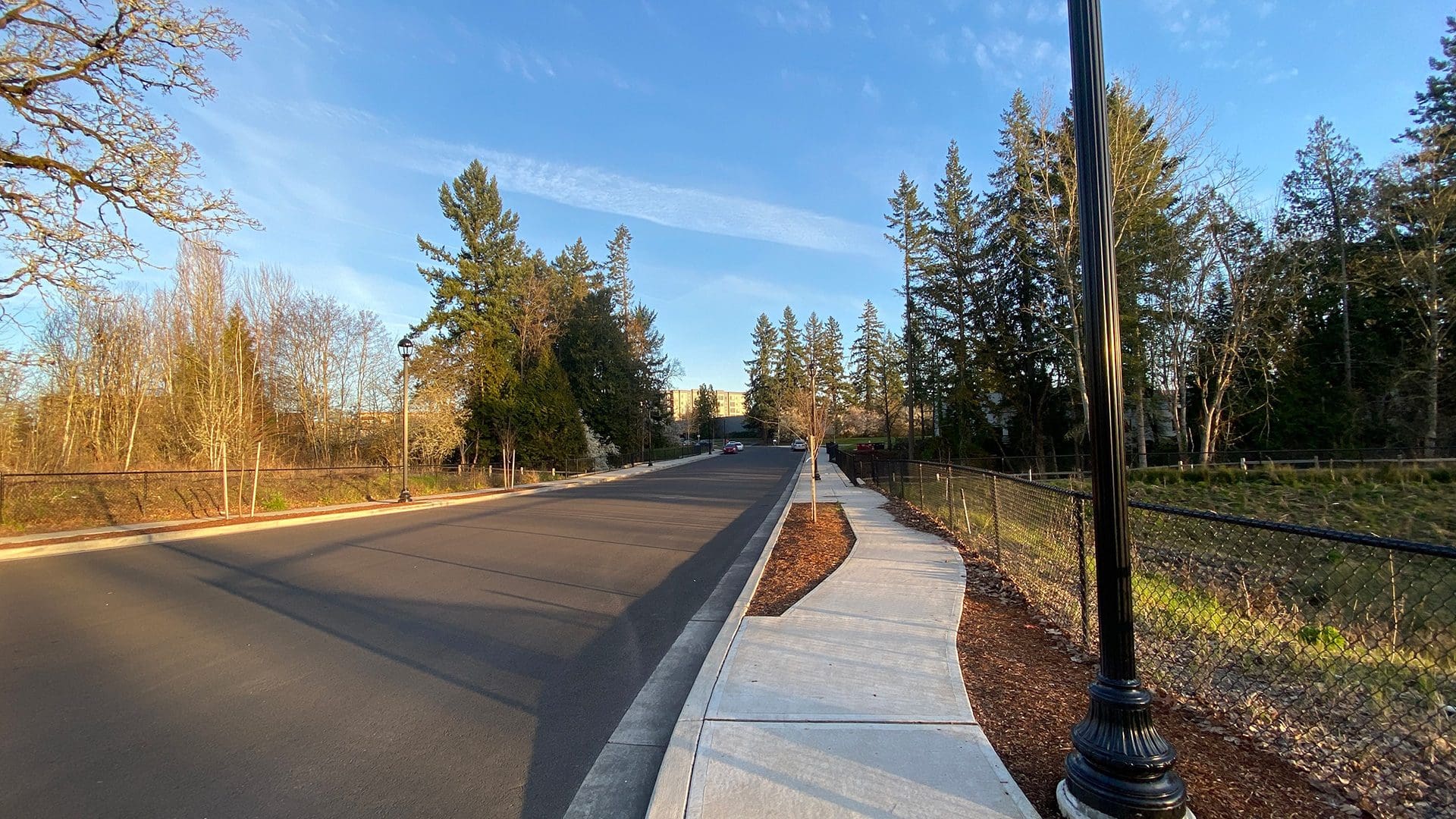
#7: Multimodal Enhancements Through Wetlands
Cherry Drive and Century Boulevard: Hillsboro, OR
The Cherry Drive and Century Boulevard projects in Hillsboro were driven by the need for community connectivity. Century Boulevard was widened through wetlands to provide a sidewalk and bicycle lane connection to Cornell Road, and extending Cherry Drive supported connectivity in the region among commercial, office, and residential uses.
The design team was able to mitigate the wetland impacts of both projects at the Cherry Drive site, providing an ecological solution for the entire drainage basin. Understanding where the sewer pipelines were located was critical to selecting the proper culvert size to span both the creek and the sewer pipes without causing settlement or impacting the active flow channel of the creek.
Working closely with the adjacent Sonrise Church, we integrated the sidewalk and stormwater design on Century Boulevard to match their planned improvements; in exchange, the church donated the required right of way and easements necessary to construct the road improvements. In addition, close coordination with City of Hillsboro and Trimet Light Rail staff led to a successful implementation of one of the most complex traffic signals in Hillsboro.
#8: Making Roadway and Drainage Alternatives Three-Dimensional
Aerospace Parkway: Phoenix, AZ
It’s always a good day at work when we get to play with 3D models. To complete the concept development and final design for Aerospace Parkway in 10 months (with Pima County and Borderland Construction), we applied an integrated design process that focused on developing a robust 3D design model in the concept stage. The 3D design model was used to rapidly produce, evaluate, and cost roadway and drainage alternatives, as well as assess value engineering suggestions and other ideas that were generated throughout the design process.
The visualization capability with the 3D model enhances the ability to convey complex design alternatives (i.e. drainage inlets/outlets, detention basins) to team members, decision makers, and the public. The CMAR found great value in the 3D model, allowing them to better understand the design and to generate quantities for their GMPs.
Read more about this project here.
—
Public works is a piece of all of our design projects in some way, and you can read more about them on our website! During this Public Works Week, we also say thank you to the many people whose hard work contributes to the construction and maintenance of public works infrastructure that benefits our communities. From planning and design to construction and maintenance, public works professionals are “ready and resilient”.
And thank you to the storm drains, streetlights, and bridges too.