Challenge
Fort Lauderdale’s SE 17th Street is busy. The corridor is home to many activity centers, including a convention center, a major port, and several retail stores. Most importantly, the corridor serves as Fort Lauderdale’s southernmost connection between the mainland and the barrier islands – where world-famous Fort Lauderdale Beach is located. Recurring and non-recurring congestion has been an ongoing issue on SE 17th Street for years.
Solution
Kittelson led a comprehensive study that resulted in over 80 multimodal solutions for managing congestion. To better understand the impact that various solutions would have in addressing congestion, Kittelson also assessed the origin-destination patterns of motorists using SE 17th Street. The origin-destination study relied on cell phone data collected by StreetLight Data. StreetLight Data processes billions of geospatial data points to measure how pedestrians, bicycles, cars, and other modes interact.
The Kittelson team worked hard to make sense of the seemingly infinite combinations of origin-destination pairs and time periods. Through the use of simple data visualizations, Kittelson was able to communicate the “big picture” findings to a general audience of neighbors, planners, and business owners.
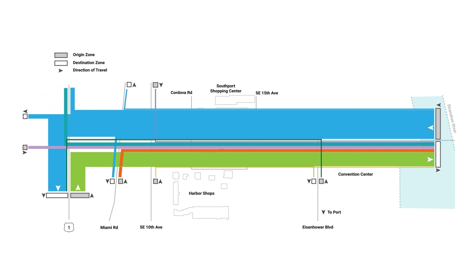
A bandwidth plot shows relative traffic volumes while conveying a sense of geographical location
A bandwidth plot shows relative traffic volumes while conveying a sense of geographical location.
The Outcome
Using Origin-Destination Data to Support Investment Decisions
The City of Fort Lauderdale is using the origin-destination insights developed by Kittelson to prioritize and advance projects that:
- Increase network connectivity;
- Enhance transit service;
- Improve the walking and bicycling experience; and
- Off-load traffic from the most congested intersections