February 25, 2026
The smallest state in the U.S., Rhode Island is approximately 1,214 square miles of land and water. (For reference, you could fit Rhode Island into Alaska roughly 480 times.) This compact size can lead to assumptions about transportation planning: that shorter distances, smaller jurisdictions, and closer proximity to major metropolitan areas up and down the northeast corridor reduce complexity.
But in reality, Rhode Island’s small size presents a distinct set of transportation challenges and opportunities, both of which demand planning approaches grounded in interdisciplinary thinking and local realities. This is one of the many reasons Kittelson & Associates recently established a dedicated office in Providence, RI.

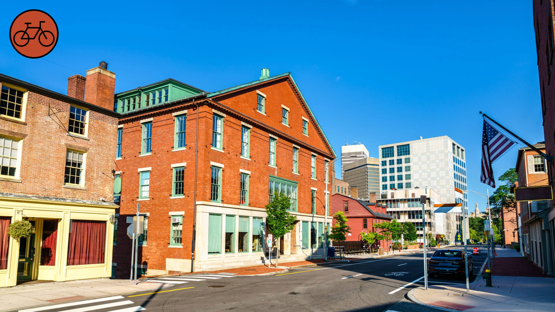
Providence, Rhode Island—the site of our newest office. Source: iStock.
Here is a breakdown of four unique conditions shaping transportation planning in Rhode Island today.
1. Density as a Mixed Blessing
While Rhode Island might be geographically small, its population is not. Within this state—which is only roughly 48 miles long and 37 miles wide—you’ll find approximately 1.1 million people, making it the second-most densely populated state in the country.
Density can often be an asset, especially in terms of transit and multimodal transportation. Concentrating demand in a smaller geographic area makes high-frequency service financially viable and convenient for users, facilitating more walkable and bikeable transportation networks.
But density can also limit flexibility, especially in New England, where many cities and towns were built long before our modern expectations for sidewalks, bike facilities, transit lanes, and complete streets. Today, that means many corridors simply don’t have enough physical space to accommodate every desired mode.
Their history means Providence’s streets are often tight—here, pavement marking indicates that bicyclists must share a travel lane with cars. Source: Adobe Stock.
With limitations like this, transportation planning often becomes an exercise in tradeoffs, like determining how to fit sidewalks, bike infrastructure, travel lanes, and transit within constrained rights-of-way while maintaining safety and accessibility for all users. Solutions must be precise and tailored rather than relying on standard cross-sections or one-size-fits-all designs.
Live from Rhode Island: From Theory to Local Application
Kittelson is no stranger to these tradeoffs, having authored NCHRP Report 1036: Roadway Cross Section Reallocation: A Guide. This report focuses on how communities can better weigh their options when considering how to reallocate space within a roadway.
As part of a recent presentation shared in partnership with the City of Newport at the 2025 Southern New England American Planning Association Conference, Megan Mello, AICP and Conor Semler applied this guide’s framework to America’s Cup Avenue in Newport. Exercises like this, even if theoretical, help to demonstrate what is possible within our existing streets, even in a colonial New England city such as Newport.
2. Geography Defined by Water
Rhode Island’s geography, and therefore its transportation system, is defined by 384 miles of tidal shoreline, lending the state its official nickname of “The Ocean State.” This landscape has shaped travel patterns, infrastructure, and industry in fundamental ways since the state’s founding. Historically a center for shipbuilding and fishing, today Rhode Island is still very much at the center of the “blue economy,” with key transportation players including the Newport Naval Station, its associated maritime and defense partners, and the port of Providence, also known as ProvPort.
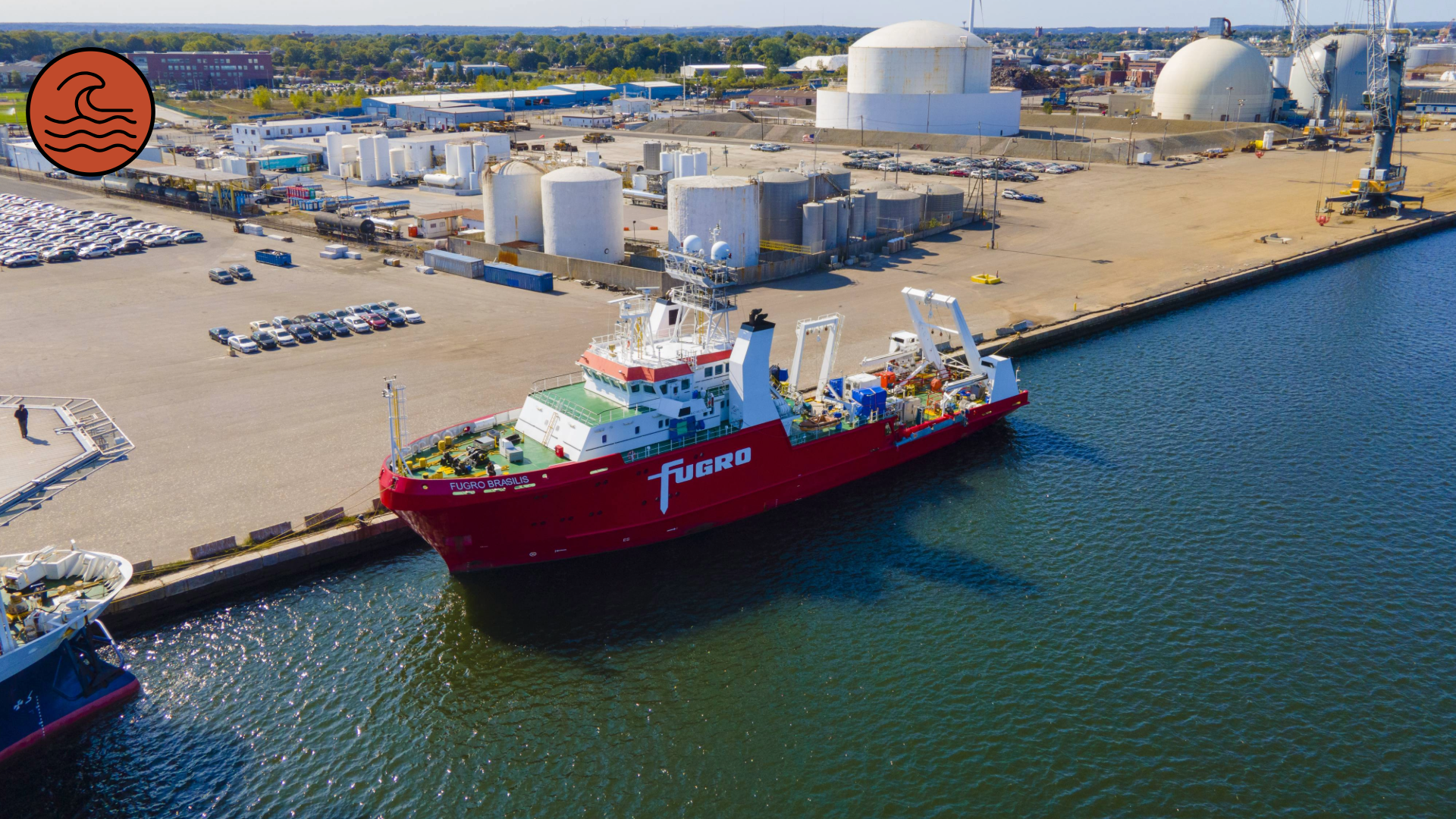
A cargo ship docks at ProvPort, one of only two deep water ports in New England. Source: Adobe Stock.
Another effect of Rhode Island’s coastal nature is the fact that rivers, inlets, and bays require an extensive network of bridges, 1,200 of which are managed by the Rhode Island Department of Transportation. Many of these bridges serve as critical connections with few viable detour options, meaning that if something goes wrong at one of these crossings, impacts can ripple quickly through the surrounding network.
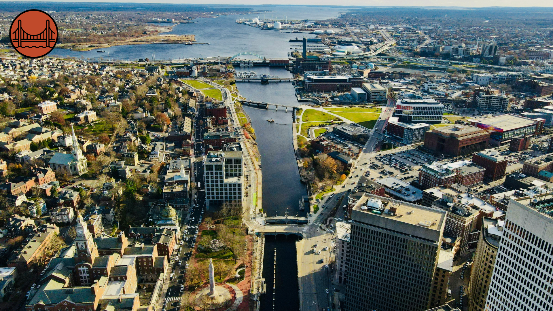
Water gives Providence so much of its character and beauty – but it also requires a reliance on bridges, which can be chokepoints in a transportation network. Source: Nils Huenerfuerst, Unsplash.
By diversifying the populations the bridge can serve, these critical amenities become somewhat more resilient; that’s why, across the state, there is growing interest in adapting bridge infrastructure to support walking and biking—expanding access and providing alternatives to driving in places where detours are not feasible.
Live From Rhode Island: Reimagining Bridges and Waterfronts
One example of the state’s effort to reimagine its bridges is the Henderson Bridge corridor between Providence and East Providence, where federal funding recently supported the replacement of a six-lane structurally deficient bridge with a three-lane bridge and separated shared-use path. The state has also secured federal funding to explore the feasibility of adding shared-use walking and biking facilities to the Pell and Verrazzano bridges, which connect South Kingstown, Jamestown, and Newport, RI. At Kittelson, we’ve helped agencies identify creative, multimodal solutions to bridge bottlenecks before, such as with the Tobin Bridge in Boston, MA.
Meanwhile, the state government has also been intentional about modernizing waterfronts to preserve Rhode Island as a player in the blue economy. In recent years, the Quonset Business Park and Port of Davisville, located on the coast of Narragansett Bay in North Kingston, RI, have become case studies in modernizing historic working waterfronts.
Specifically, Quonset is home to more than 15,000 employees across more than 260 companies. Part of why Quonset is an attractive home for so many local businesses is its multimodality. In addition to being an active port, it also boasts the following:
- More than 14 miles of rail
- A public airport
- A ferry terminal
- Access to three public bus routes
- Tenant REGENT, builders of an all-electric sea plane aiming to revolutionize coastal transportation
3. Multimodal Potential
Despite the state’s small size and density, the automobile remains the primary mode of transportation for Rhode Islanders. Most trips are still made by car, even if the distance is well within the range of biking, walking, or transit.
The modal tide is shifting, however, and more Rhode Islanders are starting to seek out other transportation options. The good news is that the foundation for a more robust multimodal system is already in place. Bus transit service, provided by the Rhode Island Public Transit Authority (RIPTA), is within a half mile of nearly 70% of state residents. While RIPTA has long faced funding constraints, ongoing advocacy, particularly from the Providence Streets Coalition’s Save RIPTA Campaign and Grow Smart RI’s broader transit advocacy, has played a central role in keeping public transit investment on the state’s agenda. This sustained public pressure has helped maintain RIPTA’s visibility and underscore the need for stable, long‑term funding.
Transit and multimodal access are also increasingly central to broader conversations around housing affordability, workforce access, and economic development, as evidenced by RIHousing’s recent Transit Oriented Development (TOD) Zoning Grant Program. With this program, Kittelson is helping the City of Cranston identify areas with potential for transit-focused, mixed-use development.
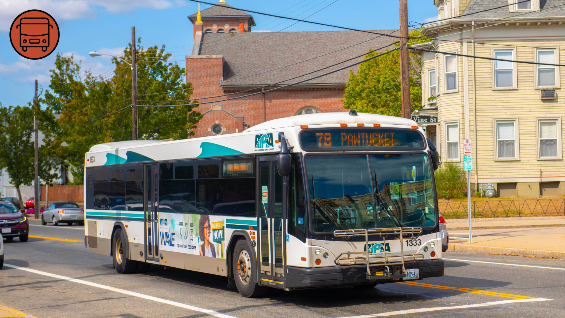
RIPTA provides transit service for a population that is increasingly invested in multimodalism. Source: Adobe Stock.
Live from Rhode Island: Paths for Play and Work
While Rhode Island already boasts several beloved regional shared use paths, including the East Bay Bike Path and the Blackstone River Bikeway, a series of recent planning and infrastructure projects have the potential to expand this recreational access to broader utilitarian trips. For example, the City of Providence has been investing in improvements to the Woonasquatucket River Greenway over the past several years. The Rhode Island Division of Statewide Planning, which doubles as the state’s Metropolitan Planning Organization, is also supporting a number of multimodal projects across the state, including the Complete Streets Plan and Design Guide, RIPTA’s Metro Connector Alternatives Analysis, and the East Providence Bicycle and Pedestrian Master Plan.
4. Opportunities to Modernize Aging Infrastructure
Like many states in the Northeast, Rhode Island’s transportation infrastructure is aging. Roads, bridges, and intersections designed decades ago are now expected to support higher traffic volumes, heavier vehicles, and a broader range of users than originally envisioned.
In some cases, this need to modernize has created opportunities to unlock access to the waterfront, enhance local connectivity, and spark new development.
Live from Rhode Island: Reclaiming Space and Reliability
A specific case of modernization leading to new opportunities is the rerouting of I-195 back in 2011, which freed up 26 acres of land in downtown Providence. Today, Kittelson’s Providence office is located within this 195 District, an epicenter of innovation, and within steps of the beautiful Michael S. Van Leesten pedestrian bridge.
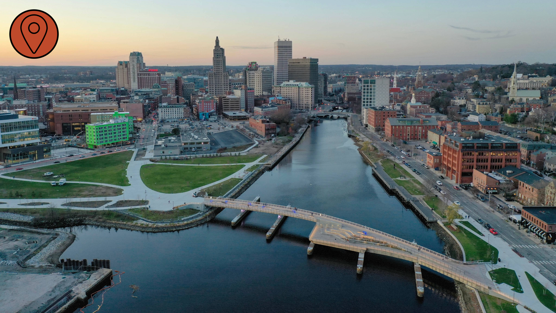
The Michael S. Van Leesten pedestrian bridge offers connectivity and a third-place for Rhode Islanders to enjoy Providence’s waterfront. Source: Adobe Stock.
More recent large-scale initiatives, such as the I-95 corridor improvements, highlight the complexity of modernizing infrastructure while maintaining daily mobility. According to RIDOT, this design-build project is the largest ever undertaken by the agency and will eliminate three of the top five most traveled structurally deficient bridges in the state, as well as improve the flow of 45.2 billion tons of truck freight annually. This effort, and others like it, requires balancing short-term disruptions with long-term safety, reliability, and economic benefits.
The Future of Transportation Planning for Rhode Island
Like many states, Rhode Island has its fair share of unique transportation challenges. In this case, the state’s history, long coastline, and small size mean that every mile matters. Rhode Island’s unique profile demands thoughtful transportation-planning solutions rooted in intention, precision, and local input.
Effective transportation planning here requires more than occasional project work. It requires day-to-day engagement to build relationships with the experts and community members who live at the intersection of statewide, municipal, and regional transportation systems.
 Rhode Island may be small, but its transportation challenges—and opportunities—are anything but. At Kittleson’s new office in Providence, led by native Rhode Islander Megan Mello, we are excited to meet these challenges and make the most of these opportunities.
Reach out to Megan to connect, share ideas, and talk about the future of transportation in Rhode Island.