August 24, 2021
When you walk off a plane in the Charlotte Douglas International Airport, you are greeted with a sign that says “Charlotte’s Got A Lot” – and there is no simpler description of the truth. Charlotte is one of the fastest growing cities in the country.
However, the growth hasn’t happened overnight. It was precipitated by decades of thoughtful and strategic transportation and land use planning and implementation. Today, because of the City’s holistic and community-based approach to transit planning, urban neighborhoods are flourishing around transit corridors, and this growth and development is continuing through planning for Charlotte’s next major light rail line.
It’s full speed ahead for Charlotte. Read on to learn how Charlotte got where they are today, and the key factors contributing to their success.

Charlotte is one of the fastest growing cities in the country. This growth was precipitated by decades of thoughtful and strategic transportation and land use planning and implementation.
A History of Thoughtful Transit Planning
Charlotte’s two successful rail lines and bus network, which are setting the stage for more exciting projects to come, came about from more than 20 years of thoughtful and proactive transit planning.
It started with the Centers, Corridors, and Wedges Vision Plan, introduced in 1994. This plan called for focusing most future growth in centers and along five radial corridors and investing in transportation and transit infrastructure that supports the targeted growth areas.
In 1998, the City released the 2025 Integrated Land Use and Transit Plan, which advanced the vision for sustainable growth supported by land use and transit investments. Consequently, a half-cent sales tax was passed through referendum, providing dedicated revenue source projected at $1 billion over 20 years.
Detailed planning for the transit corridors immediately followed. In 1999 and 2000, the City conducted Major Investment Studies (MIS) for all five corridors. The studies recommended a combination of light rail, bus rapid transit, streetcar, commuter rail, and bus systems to serve more than 200,000 riders by 2025. The region has also been building off of Charlotte’s momentum for transit through the CONNECT Beyond Study, which will define a bold regional transit vision and plan that provides real mobility solutions and opportunities for residents and visitors across two states and 12 counties in the Charlotte-Mecklenburg region.
With a “highly recommended” rating from the Federal Transit Administration in 2002, the LYNX Blue Line was the first to be advanced among the five corridors. In the early stages of planning for the Blue Line, the City immediately got to work developing land use policies and regulations and the accompanying active transportation infrastructure (streets, bike lanes, trails, sidewalks) that would support the land use vision set out the Centers, Corridors, and Wedges Vision Plan in order to make the transit system successful. And that’s exactly what happened: in 2008, a year after the Blue Line opened with 15 stations serving Uptown and neighborhoods on the south side of the city, ridership exceeded forecasts. Today, South End, one of the key districts connected by Blue Line is a model for transit-supportive residential, office, and commercial uses.
Since opening the Blue Line, the City has continued to invest in its infrastructure through a network of trail and bicycle projects, including the first protected bike lane in Uptown Charlotte in 2019.
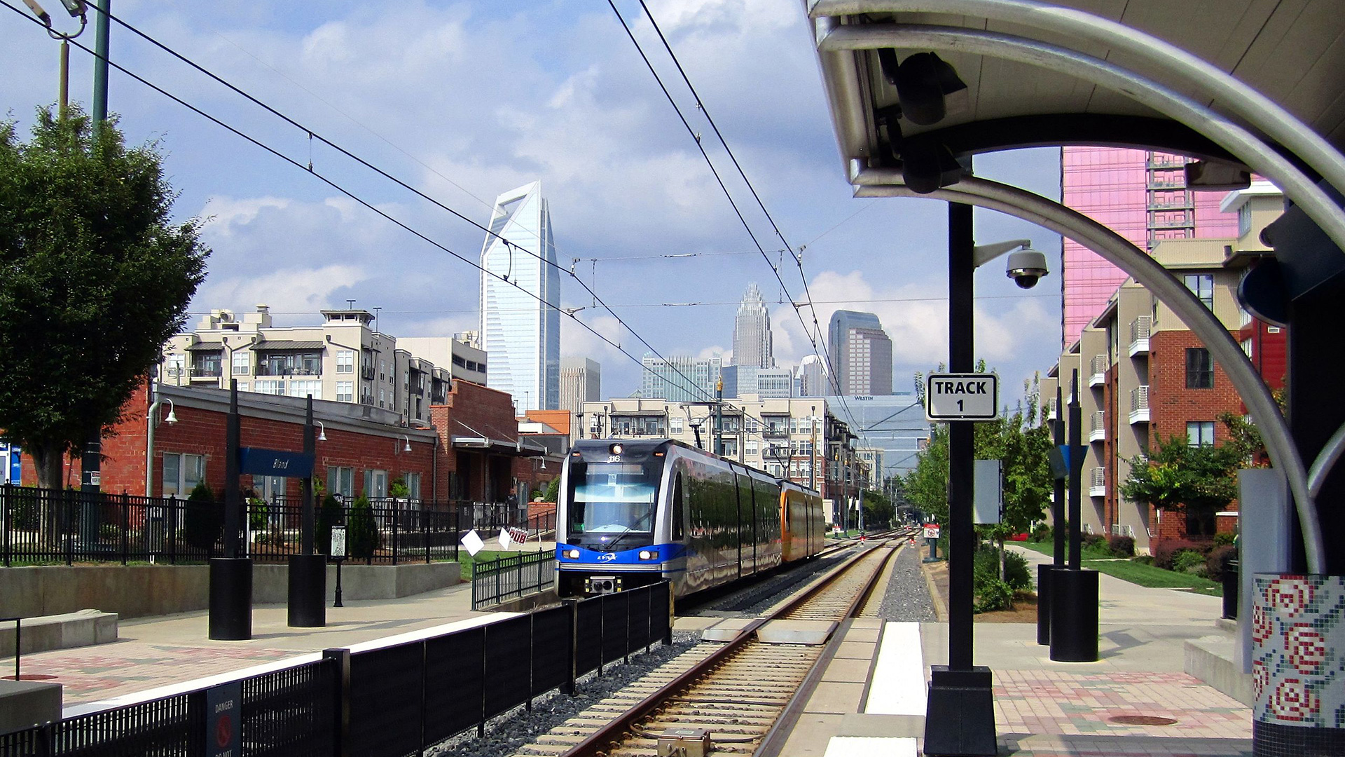
In 2008, a year after the Blue Line opened with 15 stations serving Uptown and neighborhoods on the south side of the city, ridership exceeded forecasts.
Charlotte’s Current Transit Planning Initiatives
Currently, the Charlotte MOVES Task Force is driving the Strategic Mobility Plan, which is taking the Charlotte Future 2040 Comprehensive Plan and translating the vision to on-the-ground infrastructure. One of the goals of this plan is a citywide 10-minute neighborhood, where all basic needs are met by a 10-minute walk, bike, or high frequency transit ride. We at Kittelson have been excited to support the City of Charlotte in two key transit projects that will help make this vision a reality.
LYNX Silver Line
In November 2020, the City Council took a bold step towards planning and designing its next light rail line, the Silver Line. Kittelson supported Charlotte Area Transit System (CATS) and its partners transit-oriented development (TOD) study along the proposed Silver Line, a 26-mile, multi-jurisdictional light rail line. The study included evaluating development scenarios for station areas, assessing affordable housing and economic building strategies, and identifying key multimodal infrastructure needed to maximize the reach of the stations. We are now working with CATS to develop station area plans for several stations along the corridor, integrating transit-oriented development and transportation connectivity to the stations.
Envision My Ride Bus Priority Study
Complementing the long-range planning of the Silver Line, the City is also looking at near-term changes that will improve mobility and connectivity across the city. Using origin-destination data, surveys of local residents, and operations data, we’re collaborating with CATS to identify an initial set of corridor-level improvements including mobility hubs, enhanced passenger facilities, transit signal priority, and dedicated bus lanes.
Three Factors Defining Charlotte’s Approach
The City of Charlotte is moving quickly, but decades of strategic planning have charted the course. Communities are flourishing around transit corridors due to the City’s thoughtful approach to planning, which is differentiated by these three factors.
#1: Collaborative City Structure
While every city has the intention of integrating transit projects with livability goals, the practical application of such a concept is challenging. This is partly because regional transit decisions and local community planning efforts often follow independent processes and are seldom integrated.
Charlotte is a standout example of a city that recognizes transit projects are not about building transportation systems, but about building communities. Having CATS as a department of the city makes it possible to bring this about. Charlotte’s success is not only apparent in the high levels of transit ridership, but also in how the city has accomplished livability goals while planning for and implementing transit projects.
FHWA’s Livability in Transportation Guidebook puts it this way: “Charlotte is recognized as a national model for integrating land use and transit planning. Its success story starts with a comprehensive regional vision for growth, a deliberate and aggressive policy and infrastructure response to this vision, and a city organizational structure that encourages a broad-based livability focus.”
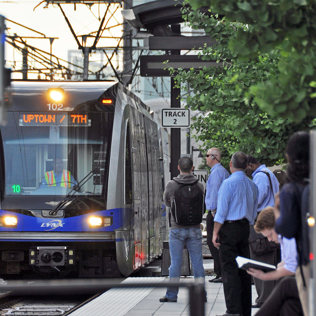
Photo by James Willamor on Flickr.
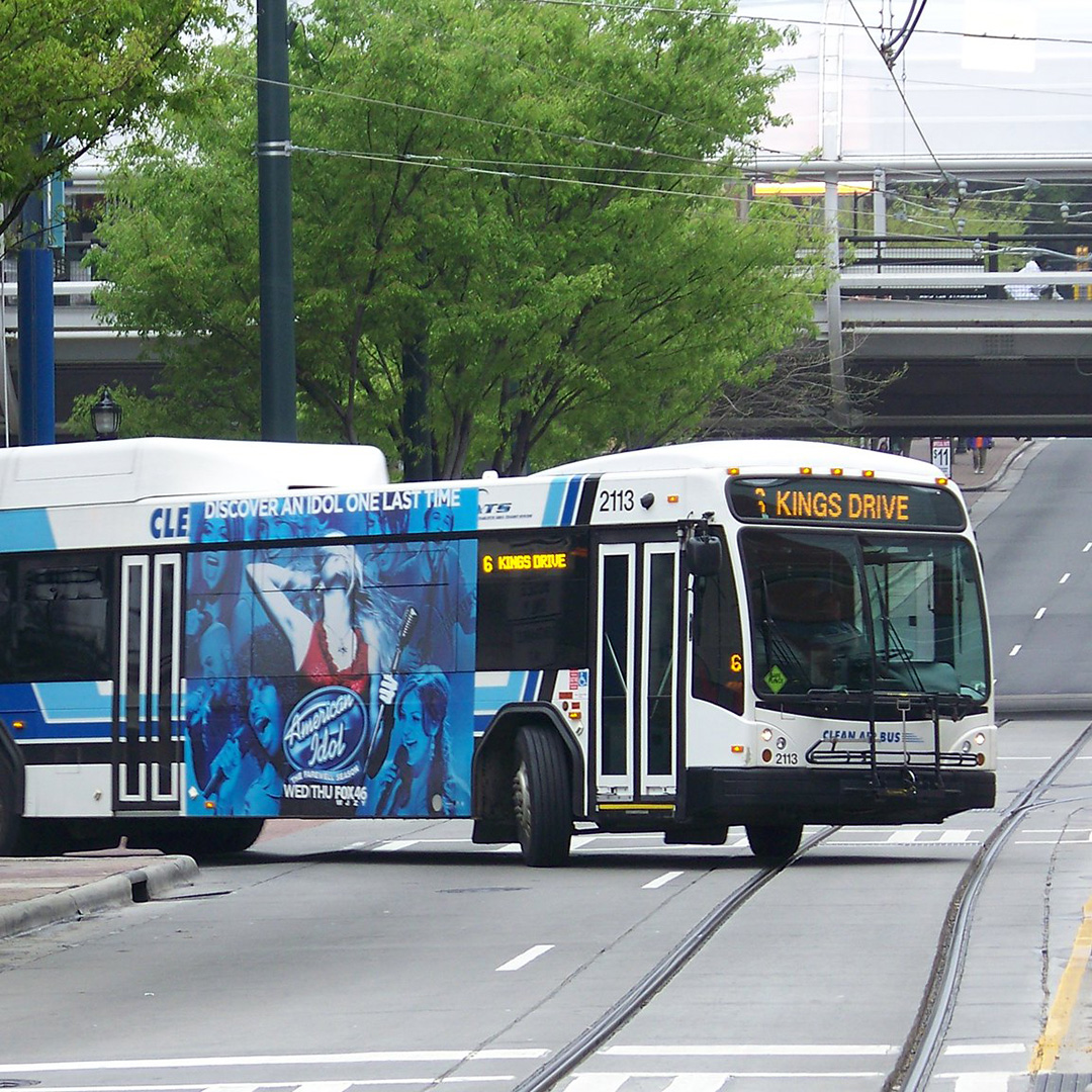
Photo by Kristain Baty on Flickr.
#2: Transit as Programs, Not Projects
Light rail is exciting! So much so, that light rail projects can be put on a pedestal, and sometimes unrealistically expected to affect massive change as standalone projects.
The City of Charlotte knows the Silver Line is not a silver bullet-just like the Blue Line was not. The impact of light rail is limited if not considered in the broader transportation context. Rather, the City is approaching light rail as part of a comprehensive program, considering how it interacts with land use, housing, pedestrian and bicycle infrastructure, and other types of transit and multimodal connections.
In line with this thinking, the City has influenced a number of development and infrastructure projects along transit lines to help those corridors become more transit-supportive and, more importantly, align with community goals. For example, prior to the opening of the Blue Line, the City’s South Corridor Infrastructure Plan (SCIP) funded 14 miles of sidewalks, 1.5 miles of multi-use trails, 10 miles of bicycle lanes, 8 miles of street widening, 7 streetscape improvement projects, and 27 intersection improvements that were all aimed at filling gaps to make the corridor transit-ready and community-oriented. The same approach was taken for the Northeast Corridor (Blue Line Extension) Infrastructure Program (NECI) to fund first and last mile bicycling and walking connections around station areas.
Charlotte is approaching light rail as part of a comprehensive program, considering how it interacts with land use, housing, pedestrian and bicycle infrastructure, and other types of transit and multimodal connections.
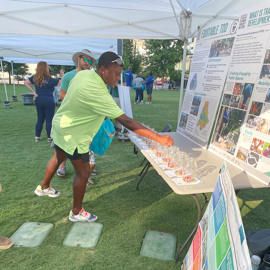
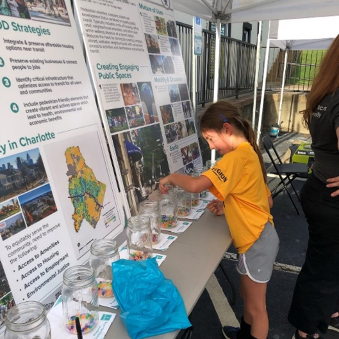
#3: An Equity Lens
Unfortunately, transit-oriented development has not always been approached with an equity-first mindset, and every city has stories to tell of residents being displaced from their homes in the name of development. The City of Charlotte, aware of this reality, has been determined to keep equity front and center with each step forward. Their comprehensive project teams include affordable housing experts and practitioners, that provide additional perspectives and avenues of community connection. All outreach is done in multiple languages. Recommendations that come out of the TOD Study will include affordable housing policies and strong linkages to implementing the City’s Equitable Growth Framework that is part of the City’s new Comprehensive Plan.
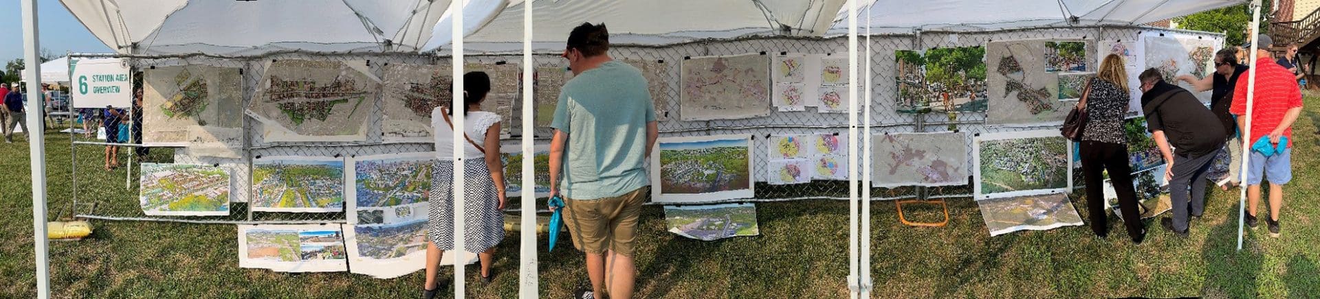
The City is also prioritizing meaningful and active two-way engagement with residents. In Summer 2021, CATS held a series of six public workshops to collaborate with community members in planning for the Silver Line, and describe what an equitable transit-oriented development approach looks like. Each community meeting was located at a future station site and structured as an open house. In the first few booths, community members learned about equitable transit-oriented development, then they moved to a large pin-up of maps that illustrated plans for that station, and provided feedback on the approach and the planned development.
Invested in Charlotte’s Future
Our work in Charlotte carries great meaning for our team. We believe in Charlotte’s thoughtful, equitable approach that leverages transit and transportation investments to build communities and create thriving, context-sensitive places for decades to come. Our staff are fortunate to have been with the City in the planning and conceptual stages of the City’s first light rail transit line and thrilled to see many of the City’s forward-thinking ideas translate to real projects that are improving people’s lives.
For several Kittelson staff, Charlotte is also home! We’ve relocated from other Kittelson offices and communities due to the exciting potential of Queen City, and we’re here to stay.
Feel free to contact any of us further to discuss any of the ideas in this article: