
November 4, 2026

For over half a century, public lands have been beloved places for mountain biking. The challenge of a grueling climb. The thrill of a fast descent. The focus required to navigate rocks, roots, and switchbacks. Enjoying all these experiences in a natural environment is what draws people to recreational areas in the first place.
Mountain biking has historically been exclusive by nature, requiring both an appetite for adventure and the physical ability to power through tough climbs, technical terrain, and long distances. So bicycle manufacturers eager to grow their customer base did what all industries do: they sought to innovate and introduce new technologies to mountain bikes (MTBs) to increase participation in the sport.
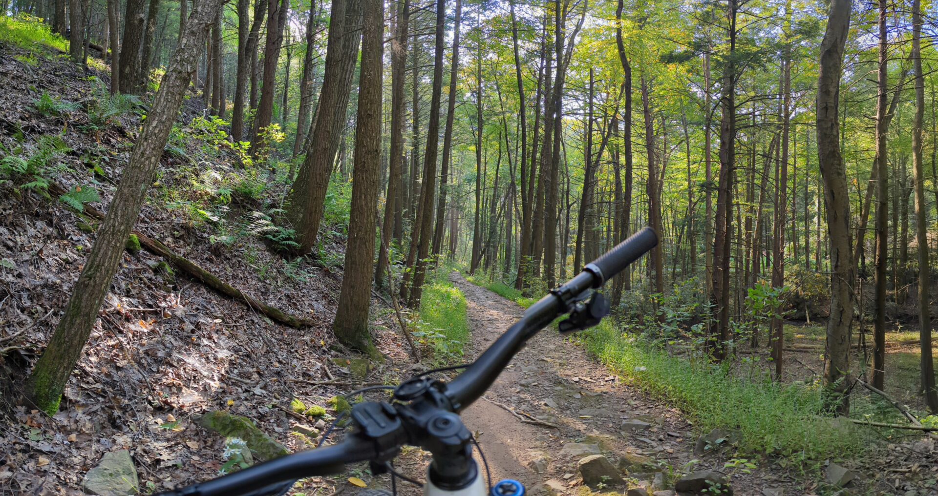
For over half a century, public lands have been beloved places for mountain biking. Source: Jonah Chiarenza.
We can trace the dawn of mountain biking technology to Mount Tamalpais in Marin County, CA, where riders bombed down gravel roads on “klunkers.” These retrofitted cruiser bikes had coaster brakes designed for riding around town. But on a two-mile descent with hairpin turns and nearly 1,300 feet of drop, those brakes produced so much heat and friction that riders had to repack them with grease after each lap. Since those first years, technological advances like stronger braking, wider gear ranges, lighter materials, and the advent of suspension continue to make the sport more accessible and provide skilled riders with ways to increase speed, extend endurance, and expand the terrain they can ride.
I’d argue the introduction of an electric motor is just one more step (albeit a major one) in this lineage of mountain biking innovations. For people who want to join stronger friends or partners, the motor-powered pedal assistance provided on a Class-1 electric mountain bike (eMTB) helps them ride together. For people with mobility or strength limitations, or age-related conditions like joint replacements, e-bikes make it easier to continue riding. For experienced riders, a motor helps them ride longer distances and reduces fatigue.
At the same time, the introduction of e-bikes raises practical questions for agencies and land managers who are under pressure to manage e-bike use on trails that were originally developed for hiking, conventional biking, and horseback riding. How do eMTBs affect the experience of people using mountain biking trails? Is it safe to mix hikers, horses, MTBs, and eMTBs in the same trail environment? If it’s not, what are our options?
Even if eMTBs aren’t your challenge, the bigger question we’re asking here may feel familiar. How do you make decisions about an emerging technology before that technology has been widely studied? Planning around new technologies is especially tricky when available data doesn’t capture the challenges new technology may pose. For e-bikes, especially on public lands, user perception surveys, personal anecdotes, and surrogate data like rider counts or injury records cannot capture the nuance land managers and trail designers need to understand patterns in trail user behavior that may pose a safety or environmental risk. Moreover, studies of e-bikes on roadways and urban trails may also have limited relevance to natural recreation areas.
So yes, this is a story about eMTBs, but it’s also a story about how to design purposeful research with findings that can inform real actions. I had the privilege of leading a research study that gives us a helpful place to start. We’ll explore the story in four movements: the question, the study, the findings, and the bigger picture for designing transportation research projects in a way that meets the needs of practitioners working to solve problems in real places.
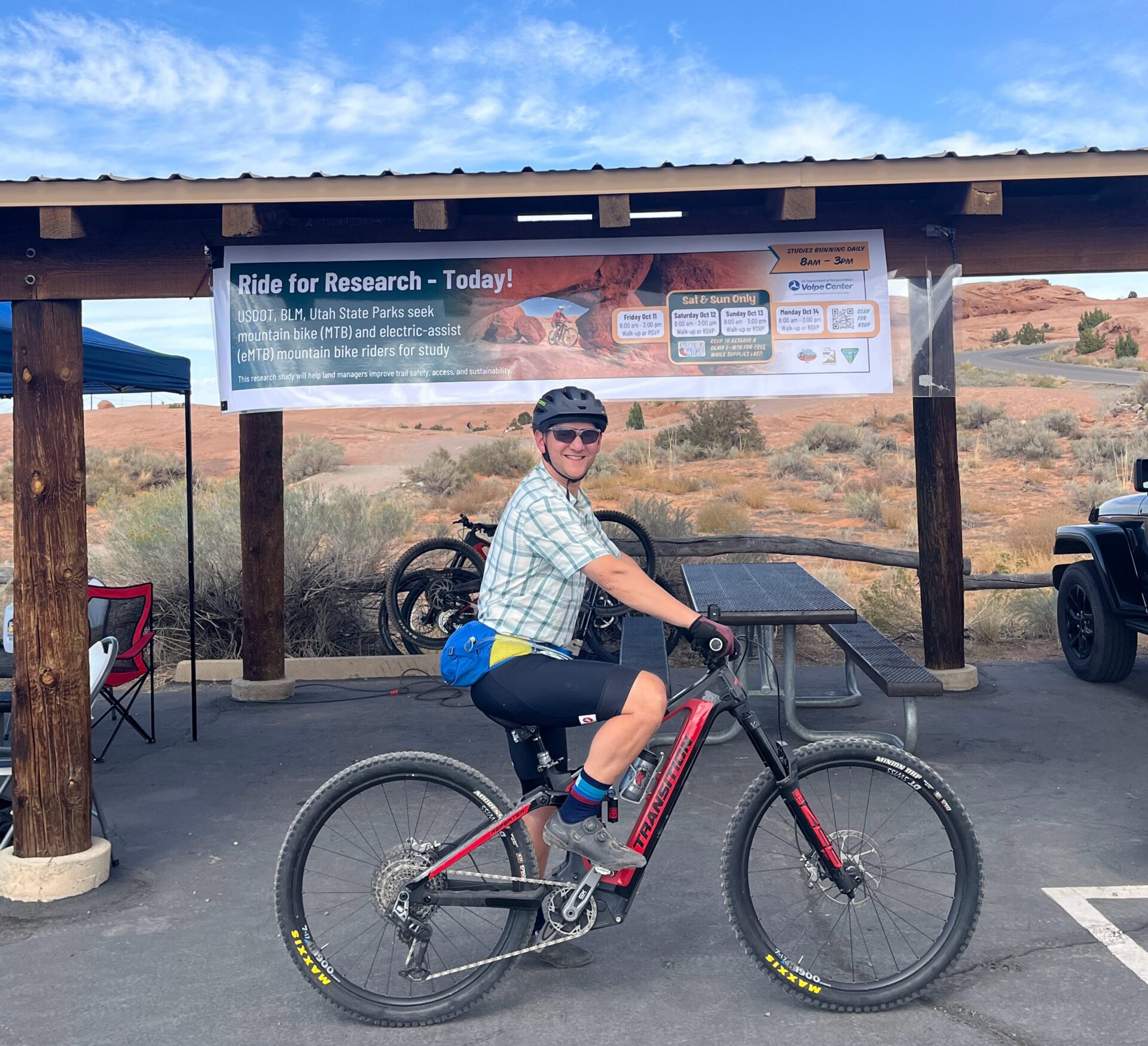
In 2022, I had the privilege of serving as principal investigator of a research team from the USDOT Volpe Center to better understand eMTB and conventional MTB rider behavior. Source: Jonah Chiarenza.
The Question: Solving for the Right E-Bike Unknowns
A research study can be wonderfully thoughtful, precise, and thorough, but its practical value depends on whether it is answering the question decisionmakers actually face. In this case, asking “Should e-bikes be allowed on public lands?” seems like an obvious place to start. But in designing a study, researchers also need to consider what actions a practitioner could take after answering that question. A study designed around an overly simple question or generic data may produce findings that offer little practical guidance in a nuanced and context-dependent reality.
A research study can be wonderfully thoughtful, precise, and thorough, but its practical value depends on whether it is answering the question decisionmakers actually face.
Most public land management agencies lack the capacity to monitor every trail, distinguish between eMTBs and conventional MTBs on those trails, and enforce policies about which bike types are allowed where. In other words, policies that limit e-bikes on trails aren’t practical by themselves (and they’re likely to result in policies and practices that distract from the challenge at hand). Conversely, questions about how the behavior of eMTB riders differs from that of conventional MTB riders, how riders of different bike types interact with one another on trails, and what trail features support or thwart these behaviors are questions practitioners can act upon.
And (fortunately for me), those questions can’t be fully answered by riding a desk.
The Study: Recruiting Real MTB Riders
In 2022, as the principal investigator of a research team from the USDOT Volpe Center (where I worked at the time) funded by the Federal Highway Administration Western Federal Lands Highway Division and the Bureau of Land Management, I had the privilege of hitting the trails to meet mountain bikers where they were already riding. The goal of our study was to better understand eMTB and conventional MTB rider behavior to help land managers and trail designers make decisions about trail access policies and trail feature design.
We recruited study participants through cycling clubs and at trailheads across three trail systems that all permit Class-1 eMTBs: Rothrock State Forest in Pennsylvania, Slickrock Trail in Utah, and Dead Horse Point State Park in Utah. Riders who chose to participate (in exchange for a $30 gift card) reported their age, sex, skill level, familiarity with the trail, and whether they were riding a Class-1 eMTB or conventional MTB. We sent them off outfitted with a handlebar-mounted, GPS-enabled video camera that captured 360-degree video and telematics data (speed and location) from their rides. Because we wanted to observe natural behavior, we did not tell participants exactly what we were measuring. We just asked them to ride as they normally would.
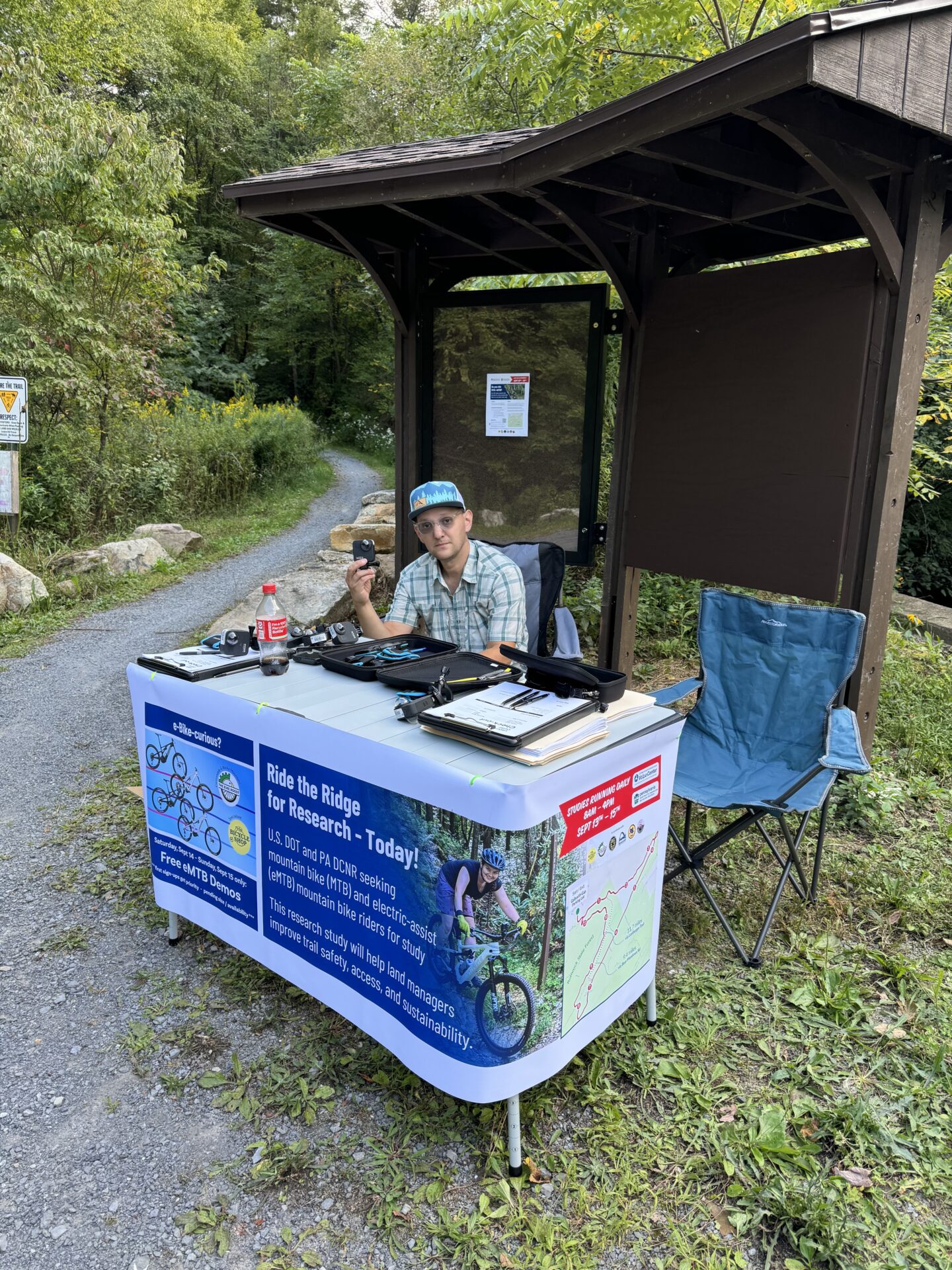
We recruited study participants through cycling clubs and at trailheads that permit Class-1 eMTBs. Source: Jonah Chiarenza
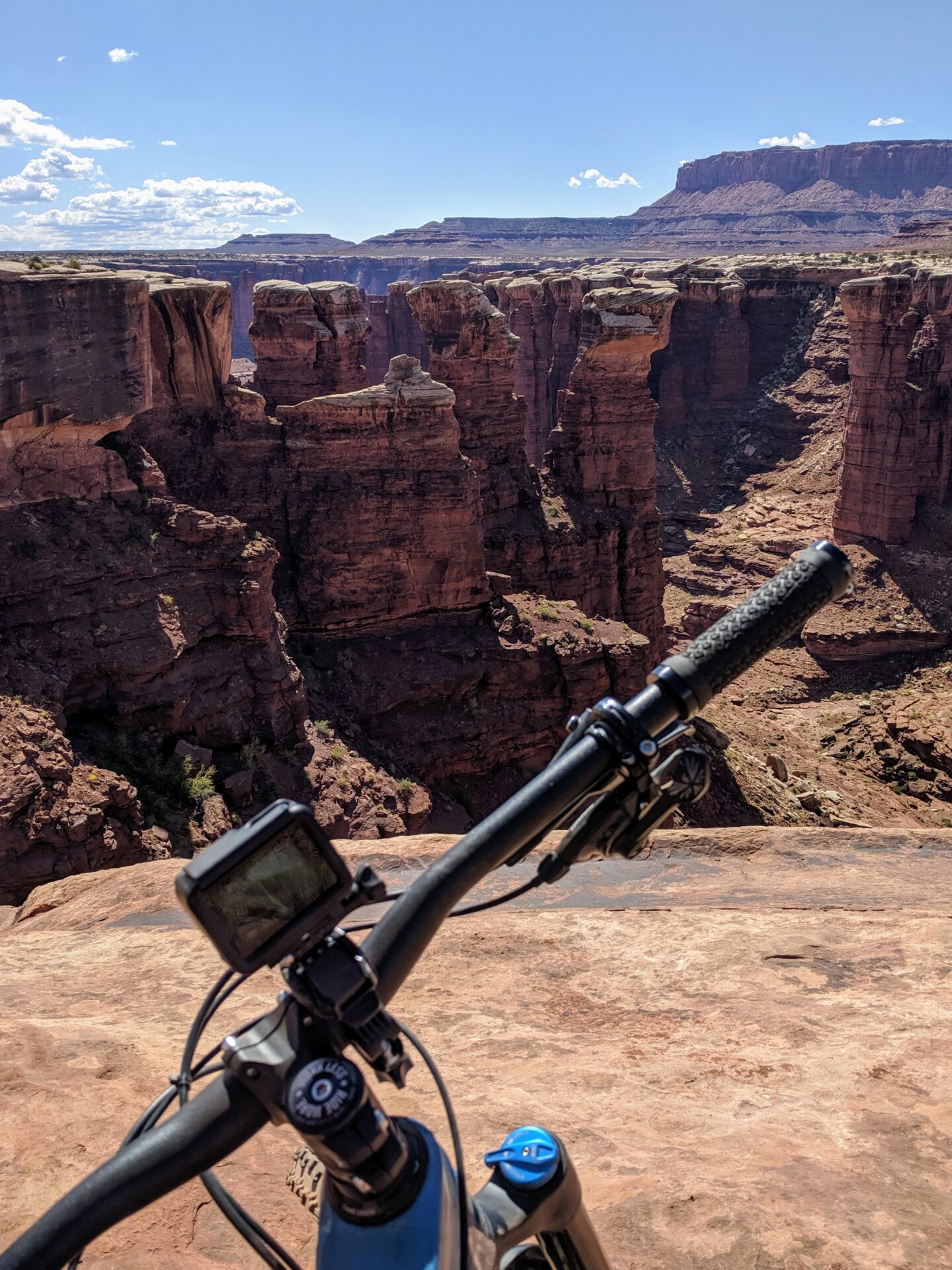
Participating riders were equipped with a handlebar-mounted, GPS-enabled video camera that captured 360-degree video and telematics data. Source: Jonah Chiarenza.
To make our results more useful for practitioners, our research team broke each trail system into segments categorized by terrain type. This contextual information differentiated between climbs and descents, technical areas with obstacles to negotiate, hazards like road crossings or trail gates, and redirection points such as tight turns.
Once we cleaned up the riders’ speed and location data, we matched it to the trail segments so we could observe how eMTB rider and conventional MTB rider speeds were similar or different, both in aggregate across each system, and within each terrain category. This level of detail made it possible to look beyond general questions like whether riders of one type of bike were faster than another, and study how our findings were shaped by rider demographics and trail context, in addition to bike type. Through regression analysis, we could isolate the key variable of bike type, helping identify where eMTB and conventional MTB rider speeds were most similar, where they most differed, and which trail features appeared to have the greatest influence on speed.
The Findings: Extracting Actionable Information for Trail Designers
Across the three study areas, we observed clear patterns in where MTB and eMTB rider speeds had more variance and where the differences were more negligible.
Speeds differed most on climbs. This checks out—uphill, where the rider is facing the hardest fight against gravity, is where the e-bike motor comes in most handy by adding power to pedaling efforts.
How this helps us: With eMTB riders climbing faster than conventional MTB riders, trail designers need to provide space for riders to pass one another on uphill trails. This finding also supports the emerging technique of making certain trails one-way and improving sight lines to reduce the risk of head-on collisions on trails where few riders could previously manage the uphill climb.
Challenging sections show similar speeds. On technical sections, around hazards, and on trail segments that require riders to change directly quickly, like tight turns, we saw smaller differences in speed between eMTB and conventional MTB riders.
How this helps us: This distinction suggests that certain trail features, like technical sections, switchbacks, or tighter turns, can function like natural traffic calming, encouraging riders to slow down or behave more consistently.
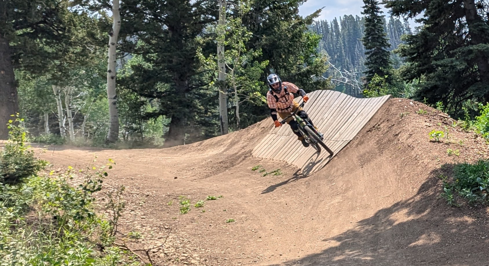
Where enforcement is impractical, design gives land managers another tool. Source: Jonah Chiarenza.
Because we collected demographic data too, we were able to observe that the difference between novice and advanced rider speed, regardless of bike type, was similar to the difference between conventional MTB and eMTB rider speed. This helps put things in perspective, since it’s very unlikely a land manager would try to create or enforce a policy limiting rider access based on skill level. Trail design that accounts for a range of skill levels, ages, and bike types will benefit everyone’s trail experience, even without eMTBs being the focus.
Trail design that accounts for a range of skill levels, ages, and bike types will benefit everyone’s trail experience, even without eMTBs being the focus.
The Bigger Picture: Knowing How to Use Your Data
The eMTB study, and studies like it, falls into the category of human factors research. Human factors studies bring depth, context, and nuance to questions that larger datasets can struggle to answer on their own. They might reveal patterns in user behaviors and interactions that aren’t necessarily leading to crashes or injuries, but are still degrading the trail experience. For example, consider an uphill climb in which e-bike riders are regularly overtaking conventional bike riders and pedestrians without having adequate space to pass them comfortably. Perhaps no crashes have occurred (and if they have, it’s highly unlikely they were documented anywhere), but the safety and experience of trail users is being compromised; people may be submitting complaints or deciding not to use the trail at all because of these interactions.
Human factors studies can also get beyond surveys or anecdotes by collecting real-world behavior data in a way that controls for context and other important details. For example, if one rider’s stats show several minutes of very slow movement, we may review the video and discover they were walking their bike. These behaviors can be properly accounted for rather than being lumped into a total average riding speed.
Of course, this doesn’t mean human factors studies replace broader datasets. For all the nuance and richness they provide, they’re highly context-specific and can be limited in their transferability. For example, we can’t assume that rider behavior at Dead Horse Point State Park—a large, open landscape with high visibility, moderate elevation change, and sandy trails—would be similar to a place like Rothrock State Forest, which features dense vegetation, longer climbs and descents, and a trail surface covered in rocks and tree roots. But we can learn a lot about how to improve the experience of people using the trails at Dead Horse Point State Park and other high-desert plateau environments like it, and Rothrock State Forest and other forested Appalachian Highlands environments like it.
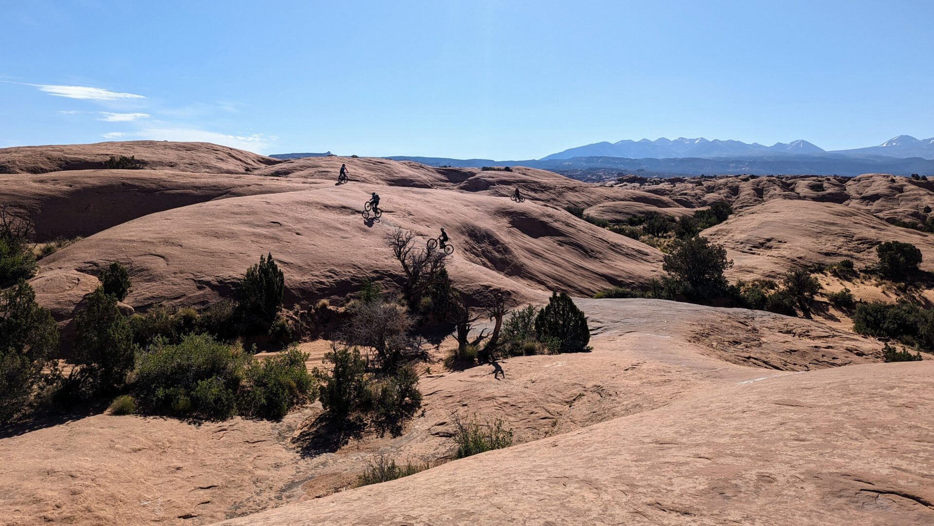
MTB riders at Slickrock Trail in Moab, Utah. Source: Jonah Chiarenza.
Every dataset is, in some ways, a snapshot. Like a photograph, it captures a version of reality at a particular moment, from a particular angle, shaped by the choices made about what to measure and how to measure it. A large dataset may reveal broad patterns across a landscape of many places or long periods of time. A smaller, more focused study may offer a sharper picture of what is happening in one setting. They are both useful, and they both have limitations. What’s important is knowing how to apply each one.
Every dataset is, in some ways, a snapshot. Like a photograph, it captures a version of reality at a particular moment, from a particular angle, shaped by the choices made about what to measure and how to measure it.
In the case of the eMTB study, each data point represents information about a rider, a bike type, a trail system, and a terrain category. Its findings do not give us blanket conclusions about all e-bike users everywhere. Instead, they help practitioners ask helpful questions: Does this trail have long climbs where MTB and eMTB speeds may differ more? Are there constrained areas where it’s important to provide safe passing opportunities? Are there technical sections or redirection points that will naturally bring speeds closer together, and if not, can we add them? The more clearly we understand the context behind the data, the better equipped we are to decide how a finding can inform real-world design and management decisions.
Connecting Research and Practice
In the introduction of this article, I posed a question: how do you make decisions about an emerging technology when the available data does not neatly match the decision at hand? In our field, we deal with these kinds of data gaps all the time. The eMTB study took a big step toward the answer by helping to fill a gap in understanding with purposefully collected, real-world data from actual public land users.
I’m getting a similar opportunity to connect research and practice as a member of the Kittelson project team for NCHRP 03-143: Framework and Toolkit for Selecting Pedestrian Crossing Treatments. In this project, we started by collecting previous studies and analyzing their real-world fidelity; in other words, how closely those studies reflect behaviors and decisions occurring in everyday life. We then went out to real crossings to fill in the gaps. We studied pedestrian crossing treatments (such as median refuges, bulb-outs, and rectangular rapid flashing beacons) across multiple cities and roadway configurations to compare similarities and differences. The nuances of studying crossing in the “real world” helped us parse out minute performance differences in these crossing treatments when it came to driver yielding and pedestrian comfort, with critical information about the roadway context intact. All of this work is meant to equip agencies for the moment when someone asks, “What is the best pedestrian crossing treatment here?”
For practitioners, the takeaway is that transportation research is most valuable when we understand what each research method can and cannot show us. A large dataset can reveal bird’s-eye-view patterns and trends. A focused field study can provide a level of context and explanation that big data misses. The work is in knowing how to put them in conversation with each other and then applying what we learn to the people and places affected by the decision. Connecting research and practice creates a positive feedback loop, and it reinforces my desire to design research studies that help practitioners make better decisions about how to use the tools at their disposal.
If you’d like to talk further about e-bikes or research methods, let’s chat.