February 27, 2021
This is one of five ideas we’re sharing for feedback as part of Kittelson’s Equity Challenge, an initiative to develop practical ways to advance equity in transportation. Learn more about the challenge and read the other ideas here.
Equity Challenge: Lack of Key Contextual Information
Neither agencies nor consultants can truly develop context sensitive solutions and trust with communities without knowing the local history surrounding their projects. Nor can we assess if our engagement practices are truly gathering perspectives from across a community when we don’t know local demographics, socioeconomics, and how they’ve shifted over time.
Brought to light in recent years more than ever, an understanding of the cultural, historical, societal, and demographical context of a given project or planning area is essential for successful and equitable project delivery.
Idea: An “Urban Forensics” Database
To address this challenge, we must use urban forensics, or the scalable process of reviewing and incorporating cultural, historical, societal, and demographical information for a given project or planning area. This can be achieved through the development of a database that allows designers, planners, and engineers to access, interpret, and incorporate qualitative information in the same way we assess other existing conditions.
There are tools at our disposal that could help us. For example: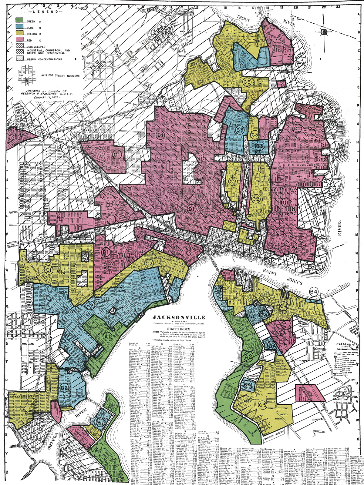
- Sanborn Fire Insurance Maps (completed across the United States between the 1880s and 1940s) give us a snapshot view of what cities looked and felt like before interstate highways and urban renewal efforts.
- Google Earth shows us historical aerials to see how a project site has changed over time.
- The Home Owners’ Loan Corporation (HOLC) was a federal agency that in addition to other financial duties, mapped 84 cities across the country showing neighborhood areas of “definitely declining” and “hazardous” which we understand today to be the racist and segregating practice of redlining.
- Social Explorer is a tool that allows us to plug in to the US Census and American Community Survey data in a spatial context.
- The Library of Congress, historical societies, state digital archives, and college/university libraries offer access to cultural and historical news archives, photography, plan and map imagery, and other information about our project neighborhoods and host communities.
How This Will Benefit Our Clients & Communities
A database like this will help us do work that is conscious of the past and sensitive to potential outcomes. Understanding what has been and why has the potential to build and/or re-establish trust with the public. As we complete more projects, the database would grow with information to serve future projects. It would help us identify when under-represented populations are not part of the public engagement process. And it creates opportunities for collaboration among agencies and consultants with local groups, schools, libraries, and historical societies.
Whaddya Think?
We’d love to collaborate! Post your thoughts on this idea, or another idea for advancing equity in transportation, to social media with the hashtag #TransportationEquityChallenge.
We’d also welcome a conversation with you. Get in touch with us at rheinrich@kittelson.com, mmorrow@kittelson.com, jweesner@kittelson.com, bray@kittelson.com, and amartin@kittelson.com.
View the other ideas that came out of the Transportation Equity Challenge here.